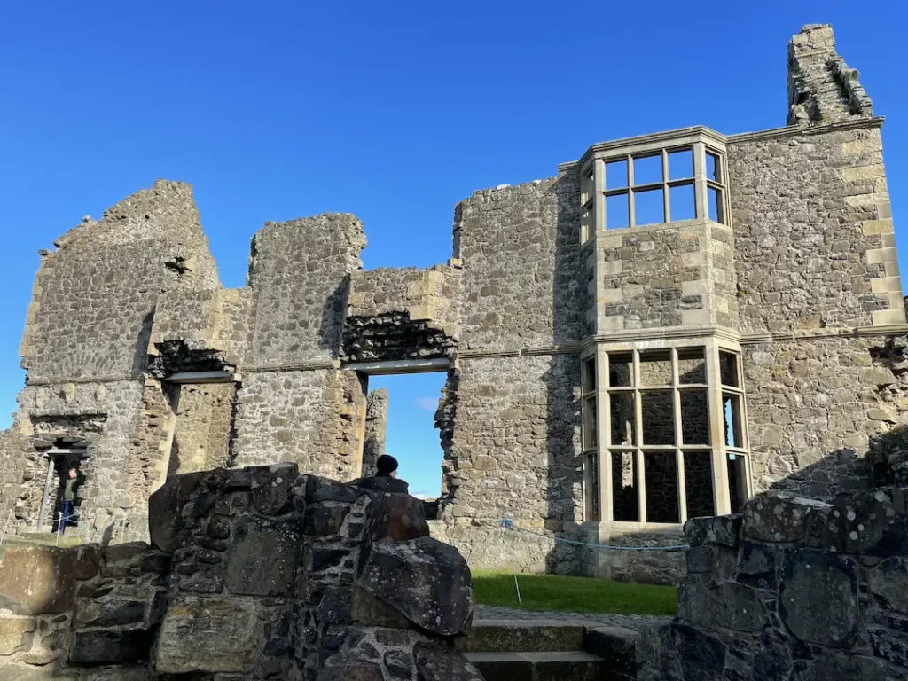
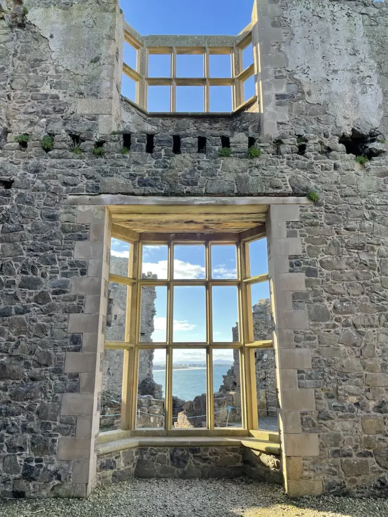
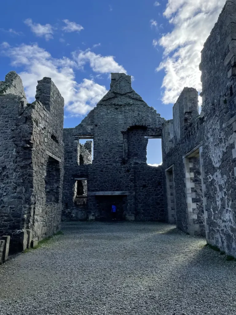
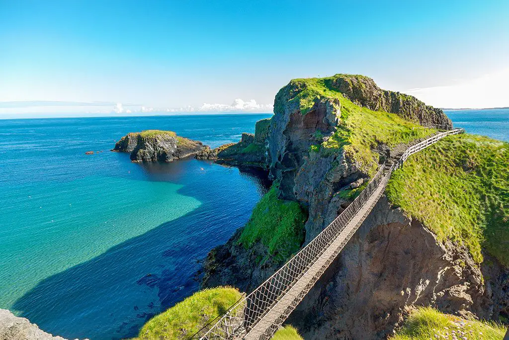
Ultimate Guide to Game of Thrones Film Locations NI

Game of Thrones Ireland

A visit to Ireland is a must for any fan of HBO’s Game Of Thrones show.  I have to admit that although I didn’t get into the show until series 3 when my wife finally convinced me to binge on it while on maternity /paternity leave, I am now obsessed. So much so that I have dragged my wife and kids around most of Game of Thrones film sites in Ireland and just recently to the Game of Thrones Exhibition in Belfast!

From our travels around The North, we’ve pulled together this Ultimate Guide to the Game of Thrones filming locations in Ireland, to help you to plan your own GOT trip to Portrush or elsewhere on the Island of Ireland.

Game of Thrones Tour

This self-guided Game of Thrones tour begins in Portrush, or if your travelling from Dublin or Belfast to Portrush then flip it around, ends in Enniskillen and covers every conceivable Game of Thrones Ireland site in Northern Ireland (That we know of)

Our Game of Thrones tour will stop at all your favourite Game of Thrones filming sites and takes at least three days to complete properly, however, we recommend taking four to five so that you can also take in some of the other fantastic areas that Northern Ireland has to offer.

Itinerary

We recommend the below itinerary…but it’s entirely up to you.

Day 1 – Causeway Coastal Route (Dothraki Grasslands to Bravos)

Day 2 – Causeway Coastal Route (Winterfell to The Red Wedding)

Day 3  – Belfast (GOT Tapestry, Exhibition and Stained Glass Windows)

Day 4 – County Down (Winterfell to Riverrun)

Day 5 – Fermanagh and the Lakelands (The Riverlands)

The Journey of The Doors

We have also included the Journey of Doors Tour along the way, so you can stop and enjoy some local cuisine and beverages as well as get your Journey of Doors Passport stamped….and possibly a picture.

Journey of the doors passport that you get stamped at all of the locations where there are doors made from the dark hedges

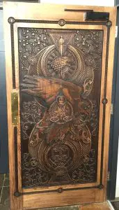
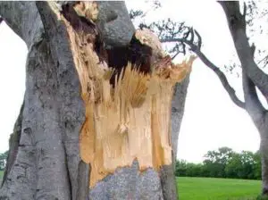
The Game of Thrones – Tour of Doors is the stunning transformation of storm damage caused to some of the ancient Beech trees at The Dark Hedges (The Kings Road) in 2016.  The wood from the trees was salvaged and given to some of Ireland’s most accomplished craftsmen and women, who transformed them into 10 uniquely designed and intricately crafted doors. Using iconic symbols and key scenes from the show, the doors work together to tell the tale of season 6. The craftsmanship on these doors is breathtaking.

They are hung in 10 places across Northern Ireland. You can pick up your Tour of Doors, Game of Thrones Passports at all these locations and a stamp in your passport will be rewarded for every door you get to see.

Where is it filmed?

In Ireland, there are over 40 locations where Game of Thrones was filmed, most you can visit and see first hand, others are sadly private and therefore off limits to tourists (although many offer private tours…worth a call), but you can see them from a distance, and possibly get a quick picture.

We have included over 50 places to visit in this tour including visits to the Ulster Museum, for the Tapestry, the Game of Thrones Exhibition, to see some of the amazing props and the six Stained glass windows from season 8.

The Game of Thrones Tour App.

While you are welcome to use (and add to if we have missed anything) this guide to Game of Thrones in Northern Ireland, you can also download a Game of Thrones Map on an app from the Northern Ireland tourism board. Discover Northern Ireland says this about the app:

The screenshot of the gAME OF THRONES APP FROM DISCOVER NORTHERN IRELAND

Bridging the gap between fantasy and reality, the interactive map allows users to flip between the mythical worlds of Westeros and Essos and the Northern Ireland filming locations. Over 25 scenes from Seasons 1-7 are featured on the app, with detailed information on each scene and where it was filmed, as well as official stills from the show. The 10 Doors of Thrones can also be found on the app. Fans can also experience the beauty of Northern Ireland from their own home as each location features a 360-degree panoramic photograph.

Game of Thrones Locations Northern Ireland

Day 1

Ok, so let us get started!

Depending on the time of year that you are visiting Portrush, the first part of the itinerary may change. As due to the large number visiting the Dark Hedges and the fantastic sunrises that illuminate the trees especially in Spring and Autumn mean it may be best to get up early and had there first when generally its only photographers and lone travellers visiting.

1. Downhill Strand (Burning of the Old Gods)

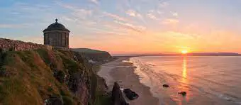
Downhill Beach Strand with Mussenden temple

Downhill Strand is a 7 mile (11km) stretch of clean white sands, overlooked by Mussenden Temple, and Downhill Demesne. The board below can be found at the entrance to the beach at the bottom of the hill.

Location on Google Maps

The Game of Thrones Location Board for dOWNHILL bEACH THAT DEPICTS THE BURNING OF THE old gods with mellisandra and stannis

Downhill beach is the setting for Stannis Baratheon’s rejection of the Seven Gods Old Gods of Westeros in Season 2 Episode 1, where, now under the increasing influence of Melisandre, they burn their old effigies as an offering to the Lord of Light. Stannis is the proclaimed as the Lord of Lights champion by Melisandre and leads Dragonstone into the War of the Five Kings.

From Downhill, Binevenagh is a short drive will take around 5 minutes to stop number two.

2.  Binevenagh (Dothraki Grasslands)

Binevenagh Mountain between Coleraine and limavady film location for game of thrones

Binevenagh is a mountain in County L’Derry about It is the westernmost point of the Antrim Plateau, which includes most of the first day’s tour. The steep cliffs and plateau expand over six miles across the Magilligan peninsula. This Area of Outstanding Natural Beauty (AONB) & Area of Special Scientific Interest towers over Downhill Beach and Mussenden Temple.

The Game of Thrones tour location board at Binevenagh showing the dothraki Grasslands film location

The best way to find out is to google Swann’s Bridge Glamping or Ballycarton House both excellent places to stay. There is a small picnic area between them, this is where you will find the above sign.

Location On Google Maps 

The Seacoast Road, below  Binevenagh, appeared in season five as the Dothraki Grasslands, North of Mereen, Essos, where in Episode 10 (Mothers Mercy) after being rescued by her dragon, Drogon while fleeing from the Sons of the Harpy in the fighting pits of Meereen, she is spotted and surrounded by a Dothraki horde.  

3. Owens Bar (Journey of Doors #5)

The exterior view of Owens bar in Limavady home to the game of thrones journey of the doors Number 5

If you follow the Seacoast Road West (the cliffs on your left), you will find yourself in the small town of Limavady. Here you will find the first of our stops on the  Journey of Doors Tour, Owns Bar, you can check out Door 5, which features the Night King and his followers, white walkers flank him on both sides commanding an army of undead White walkers at his back. Below rests the Stark Sigil entwined in branch and root, preparing for the impending attack. Make sure you get a pint of Guinness and your passport stamped.

The door number five from the Game of thrones Journey of the doors in oWENS bAR lIMAVADY

You could also make stops this day five and stop on your way back from  Enniskillen, visiting the historic walled City of Derry, then along the Bishops Road to Stop 1, 2 and 3 along with Mussenden Temple, Downhill Demense and Heslett House.

4. Portstewart Strand (Dorne)

Portstewart Strand Beach and Golf Course looking North Towards Castlerock and Donegal, filming location of Game of tHRONES

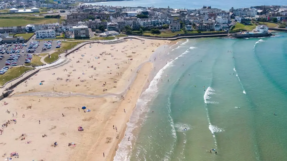
Portstewart, only 2 miles along the road from Portrush, has one of Northern Ireland’s best beaches. Stretching for 2 miles is a Blue Flag Beach maintained by the National Trust, with views over to Inishowen headland (Donegal), Mussenden Temple and on bright days to the Scottish island of Islay.

It has been a family holiday destination since Victorian times, with seaside Promenade (know locally as “The Prom”) and a great place to stop at the famous Morelli’s Ice cream or even Harrys Shack, which sits next to Portstewart Strand.

The game of thrones film location board at portstewart strand beach

The undulating dunes and sands of Portstewart Strand, featured in Season 5 Episode 4, this is where Jaime Lannister and Bronn come ashore on Dorne, fighting and killing Dornish soldiers as they seek to return Myrella, Jaime’s “niece” back to King’s Landing.

Ellaria and the sisters also plot to start a war with the Lannisters here.

Location on google maps

5. Dunluce Castle (Pyke, The Iron Islands)

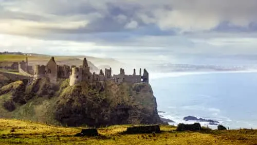
Dunluce Castle filming location of game of thrones

Along the Causeway Coastal Route, passing back through Portrush and on heading eastwards for 4 miles is Dunluce Castle.

You can find a more detailed guide to Dunluce Castle Here

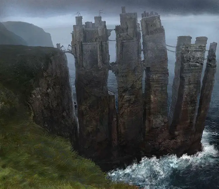
Dunluce is seemingly precariously perched on a cliff-top overlooking the Atlantic Ocean and the Sea of Moyle. In the show, it the home of the Kings of the Iron Islands Pyke. The castle above os only barely recognisable as CGI is used to position Pyke castle over various stacks of rock.

Dunluce-Castle-CGId-in-to-castle-greyjoy-in-the-stormlands-compressor

Location on Google Maps

6. The Dark Hedges (The Kings Road)

Dark-Hedges-Visit-Portrush-Northern-Ireland-compressor

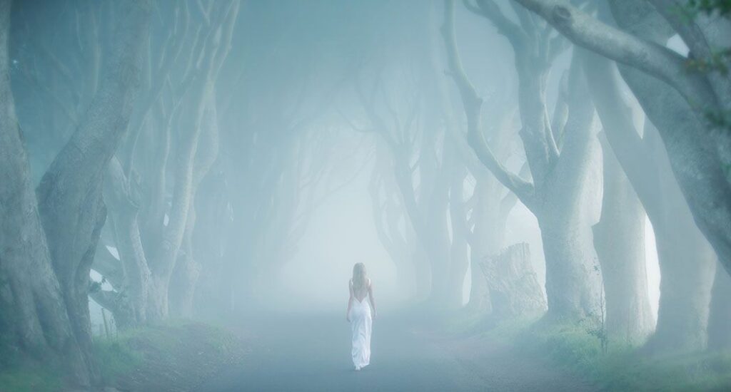
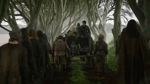
This Stunning tree-lined avenue of ancient Beech trees was planted by the Stuart family of Gracehill House in the eighteenth century and was used for filming Season 2 Episode 1 for the Kingsroad in, when Arya Stark, dressed as a boy, escaped King’s Landing in the back of a cart.

Game of thrones The kINGS ROAD ON THE DARK HEDGES VISIT PORTRUSH
The Kings Road from Season 2

Cars have recently been banned from the road itself, as it was found that the traffic was damaging the trees roots and the tour buses have been causing significant problems with transport.

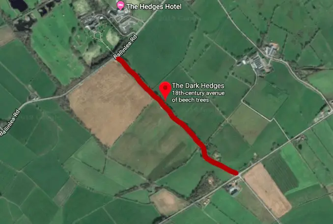
We recommend that you park at Gracehill House, from there its 5 minutes’ walk down their path to the Kings Road.

Location on Google Maps

7. Gracehill House (Journey of Doors)

grace hill house near the dark hedges in Northern ireland

Gracehill House, at the western end of the Dark Hedges is where another (Journey of Doors Number 7) famous door carved from the storm-felled trees just a few meters away.

Built around 1775, James Stuart named the house for his wife, Grace, the avenue of intertwining beech trees, that is the Dark Hedges, was once part of the entrance to the GraceHill estate.

The House has a state-of-the-art Visitor Centre, which is well worth a visit. You can then wander down to search for intriguing polygonal stones with unique formations such as the Granny, Wishing Chair, Camel and Organ.

Doors-of-thrones-Gracehill-house-game-of-thrones-visit-portrush-compressor

Signs of the recently deceased Three-Eyed Raven cover door number 7, foreshadowing the events of the past that are about to bear down on the present. You might also spot a beech tree leaf hidden within a crown, this is a reference to the Dark Hedges Trees of the Kings Road, located just a few meters away from where the door is not situated.

Location on Google Maps

8. The Fullerton Arms, Ballintoy (Journey of Doors)

The fullerton Arms Ballintoy how to the Game of thrones journey of the doors number 6

Before we head to our next stop, Ballintoy Harbour, why not take a break in The Fullerton Arms , in Ballintoy Village. The Fullerton Arms is also our next stop on the Journey of Doors tour (Door number 6).

The Game of thrones Door of thrones number six at the fullerton arm s ballintoy

Door 6 champions House Targaryen, specifically Drogon – Daenerys’ most aggressive and fearsome dragon. The Dothraki stallions in his grasp, signify their allegiance and willingness to finally follow their Queen across the Narrow Sea.

Location on google maps

9. Ballintoy Harbour (Lordsport Harbour, Pyke)

Ballintoy Harbour filming location of game of thrones

Ballintoy Harbour is a small fishing harbour located on the Causeway Coastal Route in County Antrim. The harbour itself is just under a mile from the main village, at the end of a narrow, steep road down Knocksaughey hill.

The Film location board for game of thrones at ballintoy harbour

Ballintoy Harbour features in two episodes of Game of Thrones. The first in Season 2 Episode 2, as part of the Iron Islands. This is Lordsport Harbour, Pyke where Theon Greyjoy is baptised into the religion of the Drowned God, which reaffirms his loyalty to his family the Greyjoys.

Ballintoy was also used in Season 4 Episode 2 as a location where over the burning of the Bannermen that is presided over by Melisandre, and is referred to locally as the ‘raised beach’.

Location on Google Maps

10. Larrybane Bay and headland (Stomlands)

Larry Bane qUARRY AND HEADLANDS THE LOCATION OF FILMING FOR GAME OF THRONES

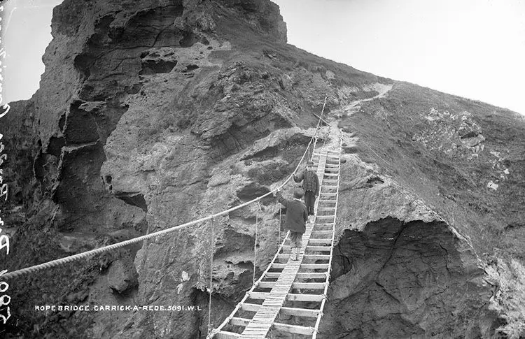
Larrybane is an old Limestone Quarry, that is now mainly used as an overflow car park for nearby Carrick-a-Rede, run by the National Trust. It is worth a Visit not only to the Quarry but to the Rope Bridge. A word of warning though due to its popularity, you now need to book ahead to get on the bridge. You can book here

larrybane quarry film location board for Game of thrones

Larrybane is the dramatic setting for Renly Baratheon’s camp in the Stormlands. It is also where Renly named  Brienne of Tarth as his Kingsguard in Season 2 Episode 3 (What Is Dead May Never Die) after she defeated Margery (is she GOTs most married woman?) brother, Sir Loras.

Catelyn Stark arrives here, on behalf of Robb Stark, to gather support and soldiers from King Renly for their quest to avenge Ned Starks death.

The Larrybane headland is sheltered by Sheep Island and the shallow reef, leads down to Northern Ireland’s great and exhilarating rope bridge challenge, the Carrick-a-Rede Bridge. We would highly recommend it.

Location on google maps

11. Fairhead (Dragonstone)

fairhead with john snow on filming game of thrones

Fairhead, near Ballycastle on the Causeway Coastal Route, rises 600 feet above sea level and is believed to be the largest expanse of climbable rock in the UK and Ireland.  

Fairhead Game of thrones Filming board

In Season 7 Ep 3 (The Queen’s Justice) was filmed here with the cliffs as a backdrop. It is this episode where Jon Snow finally meets Daenerys Targeryon and her dragons – this area is where much of the Dragonstone scenes were also filmed. You can find a good guide to the area here on NIExplorer.com

Location on google maps

12. Murlough Bay (Slavers Bay, Essos)

Murlough Bay Filming loCATION OF game of thrones

Murlough Bay sits on the Causeway Coastal Route between Fairhead and  Torr Head. Murlough Bay was also used as the location for several episodes.

Game of Thrones filming board Murlough Bay

The first was where Theon and his sister Yara road the horse back to Greyjoy in Season 2 Episode 2 (The Nights Land), then as Renly’s camp in Season 2 Episode 4 (Garden of Bones)

Also in season 2, It is then the scene which Davos Seaworth was shipwrecked after the Battle of Blackwater Bay in Season 2 Episode 9 (Blackwater)

Murlough bay filming location of Game of thrones Yara and Theon Greyjoy riding along together

Finally, it was transformed into Slavers Bay, where Tyrion Lannister and Ser Jorah Mormont are captured by slavers in Series 5 Episode 6 (Unbowed, Unbent, Unbroken). The Bay is only accessible by foot along a very steep path.

Murlough is best known for its outstanding beauty and far-reaching views across the sea to Rathlin Island and the Mull of Kintyre in Scotland.

Location on google maps

13. Mary McBride’s (Journey of Doors)

Mary-McBrides-Game-of-thrones-Door-of-thrones-number-8-cushendun-compressor

Mary McBride’s is a small bar in the heart of the picturesque former fishing village of Cushendun, indeed according to the sign in the bar, it was once one of the most miniature bars in Ireland.

Mary’s is full of history, character and has several interesting stories about the late Mary McBride, who was the landlady in years gone by.

The bar serves traditional meals all year round, we recommend the Steak and Guinness pie served with cham, it was delicious. Being a fishing village, they also have a  wide range of local seafood on offer. Make sure you even leave plenty of room for their amazing homemade desserts cheesecakes, apple pie and lemon meringue.

Mary McBrides Cushendun home to Door number 8 of the Game of thrones door of thrones

Door number 8 chronicles Arya Stark’s journey in the free city of Braavos. In the centre rests the faceless man coin that originally brought her to the city. Below this sits Needle, in reference to the final deadly confrontation that leads Arya to decide to return to Winterfell.

Location on google maps

14. Cushendun Caves

Cushendun-Caves-filming-location-of-game-of-tHRONES


The Cushendun Caves, although not very well signposted when we last visited, aren’t that difficult to find. Entering Cushendun make your way to the harbour, here you will find a statue of Johann the Goat. You may also be lucky enough to see the “new” town goat if you do be sure and feed him some apples or carrots…available from the local shops.

From here follow the road over the bridge and turn left. There is a car park towards the end of the way. However, depending on the time of day/year, more than likely it will be full of large buses and a horde of other tourists viewing the caves.

Cushendun-caves-game-of-thrones-film-board

The caves feature in Season 2 Episode 4 (Garden of Bones) where Davos Seaworth, on the orders of Lord Stannis, takes the sorceress Melisandre ashore to give birth to the murdering shadow.

Location on google maps

15. Glenarriff  (Vale of Arryn)

Red-Bay-Castle-near-Glenariff-filming-location-of-game-of-thrones

Glenariff is widely known as ‘Queen of the Glens’, it’s considered the most stunning of the nine Glens of Antrim: a deep valley surrounded by stunning walking trails and waterfalls.

Galboly-Glenariff-game-of-thrones scene of the vale of arryn

Glenarriff can be seen in Season 5 Episode 1 (The Wars to Come) as the practice ground at Runestone in the Vale of Arryn, Littlefinger and Sansa Stark observed Robin Arryn’s attempt at duelling.

The Game of Thrones marker board on the Causeway Coastal route just after Carnlough, that indicates the Vale of Arryn. Don’t miss the opportunity to take a drive through Glenarriff if you have the time it is a stunningly beautiful drive full of waterfalls, deep dark forests and lots of Irish legends.

Location on google maps

16. Carnlough (Bravos)

Carnlough filming locaton of game of thrones arya stark after being stabbedcARNLOUGH HARBOUR GAME OF THRONES FILMING LOCATIONS

Just a few miles down the Causeway Coastal Route from Glenariff and you arrive in Carnlough. Another picturesque former fishing village. The village is famous for the Londonderry Arms, that was once owned by Sir Winston Churchill. They also serve some execellent seafood, including the Irish smoked salmon we had.  

carnlough Harbour game of thrones film location board

Carnlough harbour features in is also, in Season 6 Episode 7 (the Broken Man) as location for Bravos where Arya acn be seen climbing from the waters after being stabbed by the waif.

Location on google maps

17. Ballygally Castle (Journey of Doors)

Ballygally-Castle-Hotel-compressor

This is our last stop on day 1 of our road trip to see all of the Game of Thrones filming locations in Northern Ireland.

We would highly recommend staying at this gorgeous hotel and make it a first overnight stop on your Game of Thrones Tour. By the way, they do a lovely Game of Thrones-themed afternoon tea, which makes a perfect break from touring.

We’ve also stopped here as Ballygally Castle also holds door number 9 on our Game of Thrones Journey of the Doors tour.

Game-of-thrones-journey-of-the-doors-tour-door-number-9-in-Ballygally-Castle-compressor

Door number 9 echoes the Battle of the Bastards, symbols of both House Stark and House Bolton cover the door. Swords and shields litter the door like a bloody battlefield. The battle-scarred face of the stark dire wolf dominating over the flayed man below suggests a House Stark Victory, but at a substantial cost.

So have a great evening and we will see you in the morning for more Game of Thrones Film Locations on day 2


Day 2

The Guide to Bushmills

Bushmills-main-street-toll-and-tower-visitportrush

Bushmills Village

Bushmills is a small village on the North Coast of County Antrim, Northern Ireland. Bushmills gets its name from the River Bush, which runs through the village and to a large watermill that was built there in the early 17th century.

Bushmills is classified as a village by the Northern Ireland Statistics and Research Agency (NISRA). On Census day (27 March 2011) 1,293 people were living in Bushmills.

Of these:

20.4% were aged under 16, and 21.5% were aged 65 and over

46.6% of the population was male, and 53.4% were female

How to get there

Bushmills lies just 6 miles (9 km) east along the Causeway Coastal Route, past Royal Portrush Golf Course and Dunluce Castle.

From Belfast is around 60 miles (97 km), 11 miles (18 km) from Ballycastle and 9 miles (14 km) from Coleraine.

By Car

The easiest way to get there is via car, which will take around 15 minutes; however, there are several viewpoints such as White Rocks Beach, Magheracross and Dunluce Castle that we recommend you stop and take in the fantastic scenery.

From Belfast and Dublin, the best way is to follow the A2 Causeway Coastal Route, which snakes its way along the coast through some of the most spectacular scenery in Ireland. This route as you can see on the Map Below takes around 2 hours direct…. but its worth taking longer to stop along the way

A screenshot of google maps showing two routes you can talke to get to bushmills from Belfast

However, you can drive straight from Belfast up to the M2 then A26 north towards Ballymoney, turning off at the Portrush Road Roundabout taking the third exit onto the B62 (Ballybogey Rd). Once on the Ballybogey road follow it for 6.7 miles and take a right onto the Priestland Road. Follow this until you get to Bushmills.

Public Transport

From Portrush, you can take the Translink 172 or 402 (Ballycastle) bus from Dunluce Avenue. It takes around 20 minutes and drives along the coast. You can find the timetable here.

If you are coming up from Belfast or Dublin, then one of the simplest ways to get to the castle is by taking a train. You can take a train from Dublin Connolly Station (The Enterprise)  Changing at Belfast Lanyon Place LINK TO TIMETABLE. The train from Dublin to Belfast is around 2 hours and from Belfast to Portrush is approximately 1.5 hours.

You will then have to either get the bus from Dunluce Avenue or take one of the plenty of Taxis  just outside the station.

Walk

Walk NI Map Portrush to BushmillsYou can, of course, walk the Causeway Coastal Way from Portrush to Bushmills along the coastal path through Whiterocks Beach, Past Royal Portrush Golf Club, Dunluce Castle and through Portballintrae.

It’s around 7 miles and takes approximately 2.5 hours depending on how many stops you make along the way to take in the scenery.

You can find out more about this walk on the Walk NI Website

History

An image of bushmills from the 1920s looking north towards the market square

Bushmills village, was initially known as Portcaman, can trace its heritage back to Norman times (1150-1520). The Normans of Bushmills divided the lands into structured deaneries and parishes, each with its church.

The River Bush runs through Bushmills acted as a natural boundary between the parish of Portcaman on the western bank of the river, and the parish of Billy on the Eastern bank. In the mid-1600s, owing to the abandonment of Dunluce Castle and its neighbouring village, Portcaman and Dunluce Parishes merged.

With the development of more advanced use of water-powered industry from the 1600s, the village expanded and developed and the village gained its new name reflecting this. From historical documents, Bushmills was said to have at least seven working mills on the river Bush – corn mills, flax mills, paper, timber and a spade mill – and at least five distilleries.

In the 1690s, with the “Discovery” of the Giants Causeway by Frederick Hervey, Bishop of Derry, owner of Mussenden Temple and Downhill House, and later by Sir Richard Buckley  who presented to the Royal Academy, Bushmills became a gateway and stopping point for eager visitors on their way to see the magnificent grandeur of the Causeway.

With the increase in visitors came a rise in stature of the village. Bushmills by the mid-1800s had at least three hotels, busy livestock and produce market and a thriving distillery. The Macnaghten family built much of the village including the Clock Tower and Market Square, Kane’s Commercial & Family Hotel, The Court House and the new bridge.

An old image of the Bushmills to Giants Causeway Tram outside the Causeway HotelThe world’s first hydro-electric railway came to Bushmills, in 1883, link Portrush, by now a fashionable seaside resort with its railway line to Belfast, and the village.

Ironically, due to the railway line from Portrush extending to the Giants Causeway, Bushmills was now bypassed, and the hotels and local trade went into rapid decline.

With the increased prominence of steam, gas and electricity power, enabling the industry to have their factories closer to the suppliers, the use of water power started to wain, meaning the village was left to rely on the success of the ‘Old Bushmills’ Distillery.

It wasn’t until recent times that tourism began to re-emerge as a significant benefit to the town.

Fortunately for Bushmills, the village suffered very little from unsympathetic property developments of the late 20th century, primarily due to Bushmills being officially designated as a Conservation Village with nearly 90 listed buildings.

Places of Interest

Shell RowAn image of Shell row in bushmills looking up towards the Bushmills Inn and the centre of town

This quaint row of seven cottages on the way out of Bushmills towards the Giants Causeway was built by the Macnaghten family, in 1820, specifically for the families of the workers on the Dundarave Estate.

An image of the window lintel from Shell Row in Bushmills supposedly from the giants causewayIf you look closely at the windows, you may notice that uniquely, under each window the lintel is made of a hexagonal column of Causeway Stone, thought to be from the Giants Causeway. A couple of the cottages also have stones outside the front door.

Over the years the Shell Row Cottages have been home to many workers and former worker for the Mcnaghten family and their nearby estates, including nail makers, farm hands and mill workers, today they are all privately owned.

In April 1928, the cottages hit the headlines when a curious incident occurred.

Mrs Eliza Joab, a laundress for Miss Macnaughten of Runkerry House and Lady Macnaghten of Dundarave House, was ironing clothes using a new petrol iron when it suddenly went on fire.

She threw a piece of heavy cloth on the iron which also ignited. In a bit of a panic she ran out into the yard to get a wet sack, the moment she left the kitchen, there was a tremendous explosion sending the iron through the roof damaging the ceiling and roof slates as well as blowing out the window of the back bedroom — fortunately Miss. Joab who was severely shaken by the experience was unharmed but refused to use a petrol iron for a while.

The Bushmills Railway

The Bushmills to Giants causeway tram or train at the Giants Causeway Station

The Bushmills Terminus is on Ballaghmore Road, opposite Bushmills Primary School. William Traill of Ballylough pioneered the Tramway and engineered by the Siemens Company; this was the worlds first public hydro-electric Tramway.

Powered by the River Bush, the line opened in 1883 between Portrush and Bushmills with a later extension to the Giants Causeway.

The Tram operated on its original route until 1949, when it closed. It reopened in 2002, however, now only runs between Bushmills and the Giants Causeway.

You can find out more about the Bushmills Railway Here

Alphabet Angel

Image of the alphabet angel in bUSHMILLS

The Bronze sculpture, behind the visitor information centre, was created in 2004 by the artist Ross Wilson working with members of the local community. It represents the currency of language and the unique local tongue (dialect) of Ulster-Scots. It was the first public bronze sculpture created to celebrate the Ulster-Scots dialect anywhere in the world.

The Sculpture has a plaque at its base to describe the meaning of the various parts of the Sculpture.

An image of the plaque below the alphabet angel in bUSHMILLS

The paving stones leading up to the Sculpture also have an Ulster-Scots poem inscribed in them.

The Poem reads

Here A stan Lukkin tae this

waitin Ian Whar yince a hirdin weetchil stud

Loast a wee atween dreams an sa

Or dreamin sa Streetchin braid afore him anither ree

Anither flock braid-gethered thranger far

This Ian that cried the dreamer bak for This is hame

James Fenton

The Market Square

Bushmills main-street-toll-and-tower-visitportrush

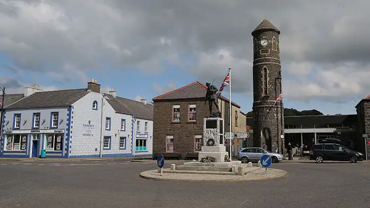
As part of efforts to improve the villages staus, a market was established in 1827. The square itself was built around 1840 by William Henry Macnaghten and was designed to be the focal point of the new town.

The Market Square, considered to be substantial at the time, had two gates facing towards the street along with covered areas in behind to protect goods like grain during wet market days. Grain, linen yarn, pork, poultry, eggs, milk, vegetables, butter and livestock, were all available at the markets.

Two markets took place each week during the 19th century, a primary market every Tuesday and a smaller market on a Friday. In 1833 a linen market opened but was not successful and subsequently closed.

The town also held four annual fairs March 28th, June 28th, October 22nd and December 12th. These were held out on the street in front of the square. A Hiring Fair also took place twice a year. Men, women and children would come to the twice-yearly Hiring Fairs. Here they line up and offer their services as labourers and domestic servants; many would find employment on local estates, farms and farm homes.

When the Tram opened in 1883, the line ran down to the market square and facilitated the carriage of goods to the harbour at Portrush. Grain, butter and other products would be shipped weekly to England and Scotland.

The Clock Tower

An image of the Clock Tower in the Market Square Bushmills

In order, perhaps, to give the town a bit of gravitas Francis Macnaghten erected the Clock Tower in 1874 on the edge of the Market Square.

It is modelled on classic Irish round towers which were common at monastic sites such as those on Devenish island and Glendalough. John Hall built the tower and today is one of the iconic Bushmills landmarks. An alcove which exists on the front of the tower  once contained a water trough for horses. Before the early 20th century the elegant conical roof of the original tower was replaced with a plainer tapered.

The War Memorial

The Bushmills War Memorial in the market sQUARE WITH THE CLOCK TOWER IN THA BACKGROUND

The Bushmills War Memorial entitled, Situated in the centre of Market Square designed and created by well known Victorian sculptor Charles Leonard Hartwell RA, FRBS, RBC (1873-1951).

The Petty Session District Court of Bushmills raised over £3000 to fund this memorial to the men of the town and surrounding district, who lost their lives in the Great War (1914 – 1918). Before its unveiling in Bushmills, the Sculpture had been on exhibition at the Royal Academy in London. Lady Macnaghten unveiled the statue on November 5th 1921.

Bushmills-War-Memorial-palque-to-Robert-Quigg-VCA plaque at the base was later added to the foot of the memorial in honour of Robert Quigg (1885-1955) who was a recipient of the Victoria Cross for at the Battle of the Somme on July 1st 1916.

Today a sculpture of Robert Quigg stands opposite the Bushmills Inn that was unveiled in 2016 by the Queen. You can find out more about Robert Here.

The Courthouse

The front of the old bushmills courthouse

The Old Court House stands on Main Street with its distinctive columnar portico and dominant presence. The Macnaghten family of Dundarave Estate built the Courthouse in 1834, to serve as the Petty Session Court for the district and a symbol of authority in the area.

The building contained a courtroom, cells and police apartments above. The Courthouse served for over 100 years as a Petty Session Court until it became a private residence in the middle of the 20th century.

The old doorway has seen the passage of endless people, answering summonses, seeking justice or merely to witness the court goings on. Most cases heard here were local misdemeanour’s. More severe or ambiguous cases would have a preliminary hearing here and then be passed on to the Crown Courts.

The range of crimes dealt with in the 1800s echoed the poverty of the rural areas. Through the Petty Session reports of Bushmills, we can take a look into the past, beyond the individual cases and into the places, characters and colour that made up everyday life in the village.

From these records, we can see that living conditions then were barely sufficient with homelessness dispossession commonplace. Crimes like poaching, begging, lifting fallen timber, or stealing bread or a free-range chicken were usual.

The last person to live in the Courthouse lived on the ground floor in the early 1960s. A resident fondly remembers her image thus: ‘I remember her standing at the front door in the gathering dusk, her slight figure silhouetted against the oil lamp in the hall behind. No doubt she often wondered what would become of the old place.

Klondyke Terrace

Klondyke Terrace Bushmills

This quaint row of terraced houses was built at the beginning of the 1900s and named after the Klondyke region of the Yukon in North-Western Canada where Gold was discovered in 1896. Funding for the construction of the Terrace came from gold found in the Klondyke, reflecting the widespread emigration and settlement of local people in that area.

The Mills

Currys Mill

An image of cURRYS mill with water wheel on the River Bush in Bushmills

Formerly and locally known as Curry’s Mill, the Mill was named after a former owner James Curry. The Mill is believed to date from circa 1816 and consists of two buildings, a three storey random rubble Mill building and a two storey double Kiln Building with a red brick lean-to at the northern end.

The Corn Mill remained in operation until the early 1950s and in the 1990s was converted to a private residence. In 2012, with assistance from the Bushmills Townscape Heritage Initiative, the Kiln was also converted to residential use, and the Mill Wheel rebuilt.

An Ordnance Survey map of 1832 shows two buildings, one being the existing Kiln building and the other being a building on the site of the primary Mill itself. As the Ordnance Survey map of 1857 has a different configuration the original Mill, which was running parallel to the Kiln and not at 90 degrees as it is now, it must have been replaced before 1857.

Though the Kiln appears to be the same on both the 1832 and 1857 Ordinance Survey maps the stonework variation between both ends would suggest that both parts were built at different times.

The kilns were located on the ground floor with red brick furnaces. There was a very steep single open staircase to the first floor where there was an external door to take the grain. The grain would have been spread out on perforated iron square plates, the perforated holes allowing the heat from the furnaces in the two kiln rooms below to permeate through. When dry, the grain was shovelled into rectangular wooden shutes for collection in sacks below.

The red brick lean-to was a later addition and did not appear on the 1902 Ordnance Survey map. It was used as the Mill Office and had its fire and chimney stack in the corner. Behind the Kiln, the building is the Salmon Fishery which was the site of a Scutching Mill (Flax) that was operating at the same time, part of this old Mill now forms the main central block of the fishery building.

Palmers Mill

am image of Palmers Mill in bushmills. The mill sits on the River Bush and has a wheel attached

Palmer’s Mill, sitting on the eastern bank of the River Bush, is also named after a former owner, acquiring its current name in the 1920s. Palmers Mill is thought to have built between 1825 and 1850. The Mill continued to operate as a corn mill and Kiln for over 100 years until the 1960s when it fell into disuse.

It is believed that an older water powered buildings stood on the site of the current Mill beside a ford that would have been the main crossing point into the village until the construction of the bridge over the River Bush.

The present owners Sam and Jan Huey took on the massive task of completely restoring the old Mill to the condition you see today complete with a fully working water wheel and associated interior mechanisms.

The Mills in Bushmills have always played a significant part in the history of the village. At one time there were at least seven in operation along the river Bush, between the Walkmill Falls and St Colums Rill at the bottom of the town. Directly behind Palmer’s Mill, was another water wheel which powered a Saw Mill run by James Dean.

The Smiling Cow

The smiling cow is a art project completed with the help of local students and catalonian students. it sits next to the river bush

The Smiling Cow was created through community and relationship building workshops with young Catalonian students from Spain, who were staying in Bushmills to better their English, and the Bushmills youth club.

Both groups shared each other’s national identity and culture through a cross-community project. The smiling cow idea won in a competition decided by the young people.

The cow contains symbols which are connected to the heritage, history and culture of Bushmills. You can see all the elements that have made Bushmills what it is today including the Distillery, Dunluce Castle, the Giant’s Causeway, the Salmon, Market Square, War Memorial and the Corn Mills which gave the village its name. The smiling cow is a welcoming symbol, welcoming visitors from all over the world to this Conservation Village.

Bushmills Distillery

Old Bushmills dISTILLERY

Well, we couldn’t write about Bushmills without mentioning the wee distillery at the top of the hill.

Bushmills and the surrounding area has had a long history of distillation. It is said that, as far back as 1276, A Sir Robert Savage, possibly the one of the Knights Templar and Archbishop of York, before leading his troops into Battle, fortified them with “a mighty drop of acqua vitae”.

Although stories and records are dating back further, it wasn’t until 1608, that Sir Thomas Phillips (An Irish adventurer) was granted a licence by King James I (James VI of Scotland) to distil whiskey in Bushmills.

“for the next seven years, within the countie of Colrane, otherwise called O Cahanes countrey, or within the territorie called Rowte, in Co. Antrim, by himselfe or his servauntes, to make, drawe, and distil such and soe great quantities of aquavite, usquabagh and aqua composita, as he or his assignes shall thinke fitt; and the same to sell, vent, and dispose of to any persons, yeeldinge yerelie the somme 13s 4d”

Hill 1887

The company that we know today as Hugh Anderson only established the Bushmills Old Distillery Company in 1784. Bushmills was not always as popular as today, suffering many lean years with several periods of closure, there is no record of the distillery being in operation in the official village records both in 1802 and in 1822.

In the late 1850s, the distillery was bought by Jame McColgan and Patrick Corrigan two spirit merchants from Belfast; forming a limited company 1880. In 1885, a fire destroyed much of the original Bushmills buildings, but the distillery was swiftly rebuilt.

an image of the SS Bushmills owned by the Old Bushmills Distillery but showing it when it was wrecked near Wales

In 1890, the SS Bushmills, steamship owned by Bushmills Distillery, sailed across the Atlantic on its maiden voyage to deliver Bushmills whiskey to the Americas. It called twice on the eastern seaboard at Philadelphia and New York City, before heading on to Singapore, Hong Kong, China and Japan. Sadly she ran aground and was wrecked on Nimrod Rock, Penrhos Bay, Anglesey on the 11th January 1911 when on passage from Liverpool for Cardiff in ballast. She was refloated on the 26th August 1911 and broken up Llanerchymor. Read more at HERE

The golden years between 1880 and 1920, Old Bushmills’ ‘celebrated malt whisky’ wins numerous prizes in international spirits competitions, including the ‘only gold medal for whiskey’ at the Paris 1889 Expo. North America was a massive market for Bushmills and most other Irish Whisky producers and this time. Prohibition in 1920s America came as a massive blow to the Irish Whiskey industry; however, Bushmills managed to survive. This was primarily due to Bushmills’ owner at the time, Samuel Wilson, who predicted the end of prohibition and had taken a gamble on buying the distillery at the start of the ban to store large quantities of whiskey ready to export to the United States.

World War II halted production as Allied troops were billeted at the distillery. Meanwhile, in Belfast, a bomb hit the head office destroying all the archives. After the Second World War, Isaac Wolfson bought the distillery, who then in 1972, sold it to Irish Distillers, who at the time controlled the production of all Irish whiskey.

Since then the distillery has passed through ownership by Pernod Ricard in 1988 and then Diageo in 2005.

In 2015 Jose Cuervo got a fantastic deal by swapping some a half share in some tequila brand for control of one of the finest producers of whisky in the world, we don’t know who it was, but you can be sure they are toasting that deal with a Wee Toddy of Bushmills finest.

In May 2008, the Bank of Ireland issued a new series of sterling banknotes in Northern Ireland which all feature an illustration of the Old Bushmills Distillery on the obverse side, replacing the previous notes series which depicted Queen’s University of Belfast.

The Bank of Ireland Five Pound £5 Note featuring the Old Bushmills DistilleryThe Bank of Ireland ten Pound £10 Note featuring the Old Bushmills DistilleryThe Bank of Ireland twenty Pound £20 Note featuring the Old Bushmills Distillery

PS There is £50 note….but we couldn’t get hold of/afford one of those. lol.

Best Places To Eat in Bushmills

Bushmills is often overlooked by those travelling along the Causeway Coastal Route, to the likes of the Giant’s Causeway, Carrick-a-Rede and Portrush without stopping, and we feel this is a mistake, as there are some fantastic places to eat in the village.

We’ve compiled a list of the Best places to eat.

The Bushmills Inn

tHE award winning bushmills in and beer garden

If there is one place that is going to persuade you to stop overnight in Bushmills, it’s the Bushmills Inn.

This multi-award winning former Coaching Inn, dating back to the 1600s, is a 4-star boutique Hotel and Restaurant is steeped in history. The 4 star Bushmills Inn blends unique rooms, beautiful grounds, stunning architecture and lovingly restored modern facilities that pay homage to its rich Irish history.

From inglenook turf fires to hayloft snugs, there’s something to find behind every door.

It’s has a cosy bar with the real fire (lovely after a windswept trip to The nearby attractions) that regularly hosts traditional music sessions… the inn even has its secret library and fantastic outdoor area…..apparently they have amazing Espresso Martini.

As an extra treat, they even host their cinema on special occasions.

Address: 9 Dunluce Rd, Bushmills BT57 8QG

Mick’s Coffee Shop

The front of mIKES coffee shop and diner in bUSHMILLS

Mick’s is one of the best places on the Causeway Coastal Route for a fry up, however, as one of the surprising and delicious secrets is that one of the owners is originally from Thailand, therefore does some of the best Thai meals around; always check out the daily Thai special.

Address: 65 Main Street, Bushmills BT57 8QB, Northern Ireland

The Copper Kettle

The Copper kettle Coffee shop on the market square in bushmills

If you are looking for a real Ulster Fry ( pancake ..yes pancake, soda bread, bacon, egg, sausage, potato bread (known as fadge locally) and either tomato or beans, then this is one to stop at.

In our short experience, if your not in by 10 on a Saturday morning, then you may struggle to get a seat as its very popular with cyclists and locals, who seem to have the serving times down to a tea before there’s a mass exodus along the coast road and the scrumptious lunchtime food served up by Carol and her staff.

This is a friendly, comfortable café situated on the corner of the market square on the road from Dunluce Castle to the Giant’s Causeway. Stop off and fill up ahead of your next activity.

Address: 57a Main St, Bushmills BT57 8QA

The French Rooms

tHE french Rooms Cafe and restaurant bushmills

On the Mains Street of the village, opposite the Visitor information centre and handy for the park and ride to the Giants Causeway, a recently opened and refurbished guest house, the French Rooms, is a pleasantly relaxed, informal and friendly licensed café/restaurant offering simple French-inspired and elegantly presented dishes priced for regular visits and not just for special occasions. You have to try Stella’s sourdough French toast and homemade scones with local jam… Amazing!

Or you can enjoy a cup of the best-pressed coffee (approved by the inlaws!) tasted in a long time; this will pick you up and give you a kick start for a wander around the local art galleries.

Address: 45 Main St, Bushmills BT57 8QA

Tartine at the Distillers’ Arms

Tartine at the Distillers arms in bushmills

Gary (the owner/head chef), Stephen (his main sidekick in the kitchen) and Paul (the restaurant manager) have created a physically beautiful space, glamorous yet welcoming, stylish yet comfortable.

The food exceeds all expectation that even the high standards that we roll out. , Gary and his team produce some of the best food along the Causeway Coastal Route, using the local, award-winning produce in ways that induce a Pavlovian Response upon hearing the name.

Gary Stewart, Tartine, has won many awards including Restaurateur of the Year, Northern Irish Tourism Award for Best Food Tourism Experience, is listed in the Georgina Campbell Ireland Guide and is current all-Ireland Chowder champion….so may be worth a try of the chowder.

Address: 140 Main St, Bushmills BT57 8QE

Mini Maegden

Mini-maegden-converted-caravan-come-artstic-grilled-cheese

It’s not often anyone recommends visiting a converted campervan for quality food. However, this teeny, tiny little camper van is worth more than a mention. Parked up close to the village, across from the Giant’s Causeway it is a food lovers heaven.

Grilled cheese sandwiches with loads of local artisan fillings and homemade pickles make this for a delicious and filling choice, especially after the brisk walk down to the Giants Causeway and back.

The two girls who have set it up (the ‘maidens’ of the name; the ‘mini’ will become apparent when you see the van!) are ex-teachers who wanted to fill people’s stomachs instead of their heads. How glad are we that they did!

Sourdough bread, fantastic local cheeses such as Young Buck, Dart Mountain Cheeses, Cavanbert, etc. are paired with award-winning meats such as Corndale Farm charcuterie, Broughgammon Farm goat, etc.

Inventive, delicious veggie alternatives are generally served, too. The pickles range from sharp and sweet to seriously spicy – all of them a perfect match to the oozy delights of the grilled cheese.

Address: 29 Causeway Rd, Bushmills BT57 8SU

Coopers Deli

The front of Coopers deli in bUSHMILLS

Coopers Deli is a takeaway Sandwich Bar, that takes its name from being run by the family that has produced four generations of Coopers to Bushmills Distillery. Run by Fiona, they offer a selection of freshly made sandwiches, Subs, Paninis and the foot long panini dog. We really recommend you try the Pulled Pork served on a Brioche Bun with lettuce, onion, peppers, bbq sauce, cheese & slaw… delicious! You can also replace the pork with pulled chicken, beef or even locally source Broughammon Goat. All our meat is from the local Butcher. Almost all of the Jams & Chutneys are homemade from fruit picked from Fiona’s own organic orchard. If you are passing in the evenings, then you really have to try the Pizzas, and pasta dishes all served from 5-9pm. It is made fresh to order.

We also stop in as she makes a fantastic cup of tea with a selection of scrumptious tray bakes.

Address – 57a Main St, Bushmills BT57 8QA

Ground Expresso

Ground-espresson-Bar-bUSHMILLS

Adjacent to the Cenotaph, set behind the clock tower. It is often missed when driving through the village. However, Ground offers a brilliant local coffee experience, and they are excellent in their quality of service, coffee and food.

They have a great selection of coffees and teas to chose from and key for us, a space at the back filled with kids toys to keep allow us to have a hot cuppa for once.

The outside seating is lovely in the sunny weather, to enjoy a spot of people watching while enjoying a cup of tea and warmed cinnamon bake (highly recommended)

Address – 64 Main St, Bushmills BT57 8QD

Creative Gardens (one for parents)

Creative gardens Cafe and outdoor kids play area bushmills

Situated just outside the village, and easily missed, is Creative Gardens Centre. Aside from being a great place to pick up all things gardening. They have a great cafe attached to it. You have to walk through the centre to get to it, but it’s worth the walk, as they serve great food and drinks.

However, the best thing about Creative Gardens is their outdoor undercover kids eating and play area. A vast area with kids climbing frames, slides, play tractors and all within easy viewing of parents at their tables. No matter what time of year you visit Creative Gardens, its a pleasant experience thanks to the overhead heaters…also great to use to dry out.

Address – 88 Ballyclogh Rd, Bushmills BT57 8XA

Broughgammon Farm

Broughammon Farm

Another recommendation that’s just outside the village on the way to Ballycastle is Broughgammon Farm. It’s only open at weekends and is run by the Cole family. They serve a great selection of Teas, coffees and tray bakes in a converted barn with roaring wood burner and rustic feel.

They are multi award winners for a number of things including

– Irish Food Writers Guild Awards 2019: Environmental Award

– Great Taste Awards 2016: 2-star award for Goat Bacon

– Best Snack (goat tacos) at The British Street Food Awards 2016

– Highly Recommended (2nd Place) at The British Street Food Awards 2016

However, the main reason to visit (aside from getting to visit the goats) is the well-stocked farm shop, full of Broughgammon fresh meat (Cabrito Goat), local produce, garden and foraged veg along with country crafts. Broughammon also hosts a number of Artisan masterclasses, butchery classes and seasonal courses throughout the year.

Takeaways

– a flash in the pan

– the hip chip

– China Garden

– the cods way

– Yi House

Bushmills Food Tours

If you love your food and want to fit as much into your trip as possible but don’t know where to start then, we would recommend a food tour.

Caroline at Irish Feast offers local, award-winning food & drink tours in the often overlooked Bushmills, Ballycastle and even on Rathlin Island.

Join this enthusiastic guide and stroll around Bushmills, visiting six unique eateries, while being introduced to the passionate people who grow, catch, make and bake this amazing local food.

Irish Feasts’ experience is set apart from your usual guided tour apart as she doesn’t just walk you around the village from stop to stop, but also points out little oddities you would probably miss otherwise.

On this tour, you’ll hear about locally sourced foods from the producers, chefs and shop owners themselves. They dive into the history and culture of the nearby coastline and countryside.

The one rule of Carolines is – come hungry!

FIND OUT MORE HERE.

Nearby

The Giants Causeway

The Giants Causeway is only 2 miles from the village.

Read our Guide here

Carrick-a-Rede

Carrick-a-rede Ropebridge is 4 miles from the Village of Bushmills. Its owned by the national trust and takes a brave soul to cross it, 100ft above the crashing waves, and onto the island.

Read our Guide here

Ballintoy

Ballintoy is situated in one of the most picturesque parts for the Causeway Coastal Route between the Giants Causeway and Carrick-a-Rede rope bridge. The area around Ballintoy has some exceptional walks, through amazing scenery that is steeped in local history. A short walk from the village is Whitepark Bay, one of the earliest settlements in Northern Ireland, with Portbradden on one side and Ballintoy Harbour (famous now for Theon Greyjoys Landing in Game of Thrones)

The Dark Hedges

The Dark Hedges are an avenue of ancient beach trees that over hang the old entrance road to Gracehill House. They have recently been made famous as The North Road in Game Of Thrones

Read our in depth guide

Portballintrae

Portballintrae is a quaint fishing village, set just outside of Bushmills and only minutes from the Giants Causeway and Dunluce Castle. This seaside destination is just like stepping back in time, with is an old coastguard station, Runkerry house and beach.

Dunluce Castle

Dunluce Castle is situated just a few miles along the coast towards Portrush. The Castle is perched on a craggy outcrop and has been made famous recently by the HBO TV Series Game Of Thrones.

We’ve compiled an awesome guide of Dunluce Castle for your here

So there you have it, we hoe that this has been useful for you in planning your trip. Wed love to hear about it, why not tag us on Twitter  (@VisitPortrush) or Instagram (@VisitPortrush) when you are here

Mussenden Temple & Downhill Demense

Mussenden Temple

Mussenden Temple is located in the stunning surroundings of Downhill Demesne on the North Coast of Ireland, not far from the small town of Castlerock in Co. Londonderry. The Temple itself sits precariously on the edge of towering 120ft cliffs overlooking Loch Foyle towards Donegal and the Atlantic Ocean.

Mussenden Temple and its surrounding views are among some of the most photographed scenes in Ireland. The Temple itself was for many years, under threat of being lost to the sea due to the erosion by the Atlantic Ocean of the cliffs on which the Temple stands, bringing it closer to the edge and ruin. It was once possible to drive around the Temple in a carriage. The National Trust, as caretakers of the estate, then carried out cliff stabilisation work in 1997 to prevent the loss of this iconic building being consumed by the sea.

The main buildings, Downhill House, along with Mussenden Temple have all the hallmarks of an 18th-century aristocrat’s neo-classical residence. The Temple itself is more of a vanity building, built in 1785 by The Lord Bishop of Derry, Frederick Hervey, as his private library.

The building it is thought was based on Bramante’s Tempietto  (resting place of Hugh O’Neill, on Rome’s Janiculum hill, itself is inspired by the Temple of Vesta at Tivoli near Rome. Micheal Shanahan, the Cork-born architect, who accompanied the Earl Bishop on one of his many visits to Italy, is thought to have designed and built the Temple.

It also serves as a memorial to the Lord Bishop’s young cousin, a Mrs Frideswide Mussenden. Mrs Mussenden, a young mother, died at the age of 22.

The inscription that runs around the building reads:

“Suave, Mari Magno turbantibus aequora ventis

e terra magnum alterius spectare laborem.”

Which translates as

“Tis pleasant, safely to behold from shore

The troubled sailor, and hear the tempests roar.”

The quotation is from Lucretius, De Rerum Natura, 2.1–2.

Downhill Demense

The main Downhill House was built by the Earl Bishop in the 1770s. After his lordship’s death in 1803, his properties went to his heirs, the Bruce family. The house suffered significant damaged in 1851 by a fire that almost entirely destroyed the library and nearby parts of the House. Bishop Lord Bristol had amassed an extensive collection of art, which was kept at Downhill. The fire destroyed many works by artists such as Correggio, Dürer, Murillo, Rubens and Tintoretto, although it was reported that most of the paintings had been saved.

Downhill House was restored following the fire between 1870 and 1874 under John Lanyon, the son of famous architect Charles Lanyon, who maintained many of the original features.

During World War Two, the Downhill was used to billet RAF servicemen and women. The Bruce family continued to own the house until 1946; by 1950 however, it had been dismantled and the surrounding land sold. The house was acquired by The National Trust in 1980; the temple had become a Trust property in the 1940s.

After the various mishaps, the National Trust acquired the buildings during the mid 20th century. They provide us with a fascinating window into the past. Downhill House is now a ruin, but the Mussenden Temple is in good shape. We can see a digital reconstruction of both the interior and exterior of these two buildings here.

History

Frederick Hervey was born in 1730. As the third son of the 2nd Earl of Bristol, he didn’t seem likely to inherit titles or property. Therefore, he entered the Anglican church as a career option and became the Bishop of Derry in 1768. After the death of his two childless elder brothers, the Earldom of Bristol passed to him in 1779.

As Bishop of Derry, he had a liberal attitude to other faiths. He believed the future of the Crown depended on fostering good relationships with all communities. He won the respect of the Catholics and the Presbyterians. He oversaw his diocese while building neo-classical mansions in Downhill and Ballyscullion.

On trips to Europe, he acquired valuable works of art to display in his magnificent homes. He also developed his ancestral property at Ickworth in Suffolk.

His marital relationship soured. He appeared to enjoy the company of Mrs Frideswide Mussenden, his Lisburn-based cousin. The unlikely friendship raised a few eyebrows, but it was probably platonic. Mussenden Temple became Mrs Mussenden’s memorial after her demise in 1785, while still in her early twenties.

Although the Earl Bishop built grand houses and collected high art, he didn’t neglect his parish work. Overseeing and leading his diocese, he carried out building works and organised pensions for retired clergymen. He gained popularity with people of all communities. People appreciated him as someone who provided employment and encouraged prosperity.

He also studied the natural phenomenon of the Giant’s Causeway as a volcanic site. He was the first to bring it to the notice of the Royal Society. He was the first prominent personality to popularise the now famous tourist attraction. Downhill House would have basked in his reflected glory.

While the main Downhill House has become ruined over the years owing to unfortunate circumstances, the estate still contains attractive features that are worth a look, here are some of the other areas to have a wander around.

The Bishop’s Gate

Bishops Gate Downhill Demense Mussenden Northern Ireland Visit Portrush

The Bishop’s Gate has an impressive Gothic gate lodge, it is also the main entrance to the Walled Gardens and the Black Glen. Have a look at the symbolic carvings, including a bishop’s mitre and several cow skulls.

The Black Glen

<<BlackGlen.jpg>>

This small arboretum is home to a wide variety of trees and is a lovely place to walk, especially to get away from the winds on the cliff-top. See whether you can spot the fish pond, and the statue of the Earl Bishop’s brother – especially his head, no-one has ever found that.

Lion’s gate

View this post on Instagram

A post shared by Andrea (@llittle.wing_red.thread.diary) on

Topped by stone snow leopards – they’ve recently been restored and now roar in their former glory. This is one of two entrances to the property.

Lady Erne’s Seat

https://www.instagram.com/p/BpMf7QDntJs/?utm_source=ig_web_copy_link

No one quite knows what this was initially, Is it a mill of some sort, or perhaps the summer-house of the bishop’s daughter Mary? Either way, it’s a lovely quiet spot from which to see the sea, a fitting reward for the climb up from the Black Glen.

The Bog Garden

View this post on Instagram

A post shared by GeoMan (@geomananz) on

This fantastic garden close to the Bishop’s Gate is home to an extensive variety of flowers, including some stunning irises. The garden was first created by Lady Bruce in 1910.

The Mausoleum

View this post on Instagram

A post shared by Douglas S Brown (@douglassbrownphotography) on


Really a cenotaph – an empty tomb built as a memorial for the Earl Bishop’s brother, George Hervey. See if you can find the statue of George that was blown off the roof in the Big Wind and now lies in the grounds.

The Mausoleum from The Earl Bishop Trail on Vimeo.

Dovecote and Icehouse

View this post on Instagram

A post shared by Emmet Doherty (@emmet_doherty) on


The round building next to the walled garden has a dovecote above, which supplied meat for the Earl Bishop’s table, and an ice house below, for keeping food fresh. The ice was cut at a nearby pond in the winter. You can walk around and through it….but watch out for the doves.

The Walled Garden

View this post on Instagram

A post shared by Emmet Doherty (@emmet_doherty) on


Like many great houses, Downhill has a walled garden. This once provided fruit, vegetables, and even flowers for the Earls. Now it houses sheep and apple trees. You can get access to the dovecote. We recommend its sheltered lawns that are perfect for a picnic.

Myths & Legends about the Main House

One of the biggest myths about the history of the Downhill Demesne is the notion that the Earl Bishop and Frideswide Mussenden were lovers.

According to popular legend, they trysted in the Temple. There’s a copy online of the painting of the Earl Bishop with a young girl, allegedly ‘Miss Mussenden’. But, Frideswide Mussenden was Mrs Mussenden née Bruce.

The Bruce family were cousins of the Earl Bishop. Frideswide’s brother, Rev. Henry Bruce, represented the Earl Bishop in his absence from Derry. The painting is officially listed as being that of the Earl Bishop and his granddaughter, Lady Caroline Crichton. The girl looks so young, it’s inappropriate in modern times to consider the pair as a couple. The cousins had a 30 year age difference.

The Bishop was eccentric and often behaved unusually for a priest. He would allegedly scatter flour on the floor outside the Downhill bedrooms at night so he could check who had been visiting other bedrooms. Could this be true?

The Bishop had a remarkable collection of art, and it’s said that much of it was destroyed in a fire. The truth is that most of the collection was saved, even if some pieces were not. Other pieces were lost when the Earl Bishop tried to shift them from the continent to Ireland after purchase.

Owing to Napoleonic activity, there was political turmoil in Europe. The Earl Bishop was even arrested and imprisoned as a British spy.

The Earls plan for his two Irish houses was to make them galleries for his art collections. Downhill housed an extensive collection of art and served as the Earl Bishop’s summer home.

Architect Michael Shanahan built the house in neoclassical style. But the design seems to show influences of Charles Cameron and James Wyatt too. So perhaps they had some early input into this design.

Game of Thrones – The Role it Plays in Downhill Today

The hugely successful HBO drama Game of Thrones has given renewed and broader exposure to the Downhill Demesne. The property and its surroundings provided a backdrop for outdoor shoots of selected scenes in Season 2 of the fantasy drama.
Episode 1 contains a particularly memorable scene featuring the characters Melisandre and Stannis on Downhill Beach, Mussenden Temple was instrumental in filming the Downhill Beach scenes. The building, which overlooks Downhill Beach, provided an excellent viewing point for the film crew. It enabled them to record the scenes filmed at that location.

In the series, Downhill Beach becomes ‘Dragonstone’. This stunning seven-mile stretch of sand, overlooked by mysterious 18th-century ruins, provided a perfect atmosphere. It blended seamlessly into the fantasy world of this ‘sword and sorcery’ drama.

This is where Stannis Baratheon pulled out the flaming sword. It’s where Melisandre chanted ‘the night is dark and full of terrors’. When visitors reach this place, they look around and see what else this location has to offer.

Nowadays, visitors can enjoy many beautiful and scenic walks in the area. Lord Frederick Hervey, the Earl of Bristol and Bishop of Derry, was the first to put this beautiful corner of Earth on the map. But in the digital age, Game of Thrones has catapulted this otherwise little-known spot into a bright future. Game of Thrones has rediscovered this gem, and the world is coming around to check it out. Don’t miss visiting this charming spot, so rich in history and backstory.

How to Get There via Car and Public Transport

Downhill House is a joy to visit. it’s situated in the peaceful rural countryside of Co. Londonderry, between the seaside village of Castlerock and Coleraine.

From Portrush, the easiest way to get to Mussenden Temple and Downhill Demense is by Car. The Temple, which can be seen from the Harbour on clear days, is only about 6 miles as the crow flies from Portrush. The trip takes about 25 mins. Leaving Portrush heading for Coleraine, once in Coleraine follow the Signs for L’Derry and Castlerock. Once you cross the River Bann, turn right at the second round about (you should have passed a retail park on your left), follow the “Greenhall Highway” and over the next roundabout, once you reach the T junction turn left onto the A2 and follow the signposts for Castlerock. There are brown signposts follow these.

However, if you are looking for a scenic route, then we recommend that you follow the A2 (Causeway Coastal Route), it will take you along the coast to Portstewart, along the river Bann, via Coleraine and through Castlerock. Both Portstewart are worth a stop for the many Cafes.

From Belfast and Dublin, a combination of the M2 and the A26 can help a motorist reach Coleraine from Belfast in about an hour and 10 minutes.

Public Transport

From Portrush you can take the bus (140 or 402) to Coleraine, or the train as they stop in the same terminal. Then change onto the (134) Limavady Bus. There is a bus stop just across the road from the main entrance. The whole journey will take around 45mins to an hour depending on connections.

From Belfast & Beyond

You can also take a bus to Coleraine from Belfast’s Bridge Street. It takes one hour and 40 minutes. The Coleraine bus goes every hour from 6am to 9pm monday to Saturday (Sunday is a reduced timetable). After arriving in Coleraine, there is a bus from Coleraine to Castlerock (see above)

By Train

The train is another great option. The Belfast-Derry train goes every hour (Mon-Sat…Sunday is a reduced service). From Belfast, or Dublin via the Enterprise, you can get off at Castlerock Train station. Castlerock is around 2 km from Downhill Demense and Mussenden Temple. From the train station, you can get the bus (see above) a Taxi (around £7) or, if you’re willing, you could walk the two-kilometres in around half-an-hour, it is a nice walk and there are some stunning views north to donegal and, more importantly, Portrush.
Guide to Dunluce Castle

Dunluce-Caste-looking-over-whiterocks-beach-towards-Portrush-shutterstock_1608649057-_1_

Guide to Dunluce Castle

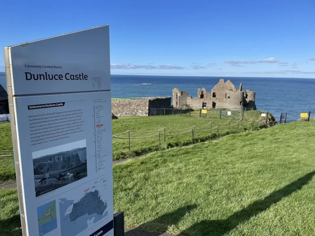
Dunluce Castle is the iconic ruin of a medieval abandoned castle set on the top of a cliff overlooking the Atlantic Ocean on the Causeway Coast Route just 2 miles east along the coast road Portrush, close to both the Giant’s Causeway and Old Bushmills Distillery. 

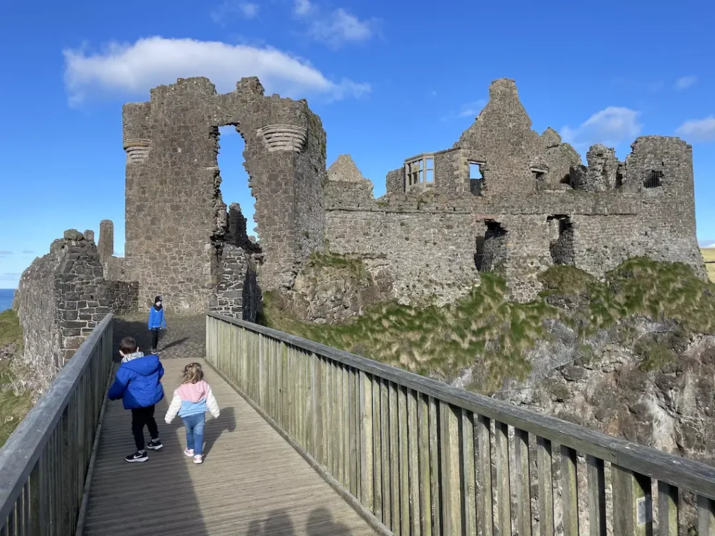
Dunluce Castle has featured in the HBO series Game of Thrones, as the House Greyjoy…..although looking slightly different thanks to CGI. The dramatic setting is surrounded by steep cliffs that drop-off on every side towards the crashing waves of the North Atlantic, meaning the only way to visit Dunluce Castle is by crossing a bridge from the mainland.

Dunluce Castle as used in Game of Thrones

Dunluce Castle History

Evidence from archaeological digs around the castle that’s Dunluce Castle has had a long and tumultuous history. From an early Irish fort or stronghold built for nearby Christian and Viking settlements on or near the current site to the backdrop of many modern TV and film productions. 

The earliest written record suggests the first Castle at Dunluce was built around the 13th century, by the powerful Richard óg de Burgh, 2nd Earl of Ulster. Richard de burgh was a close friend of Edward the 1st of England, however, his daughter was married to Robert the Bruce King of Scotland making him Maternal Grandfather to David King of Scotland.

The earliest ruins left standing today are from around the early 1500s, when Dunluce Castle served as the seat of the MacQuillans. The castle was the centre of power for their Gaelic Lordship, the area of North county antrim known as The Route. this area extended from the banks of the Bann, near present day Coleraine to the River Bush, near Bushmills.

Dunluce Castle from the Car Park

The first documented owners of the castle were the MacQuillan family in the early 1500s but were taken over by the MacDonnells in the 1550s, a Scottish settlers descended from the Scottish Clan MacDonald, after numerous battles.

The ambitious MacDonnell clan soon became the dominant family across the North Antrim, from the Antrim Glens to what is now Belfast. Although thought this time Dunluce Castle bears witness to the many conflicts they had with the surrounding families and clans.

After the Glens of Antrim were seized by famous warrior chieftain Sorley Boy MacDonnell (Scots/Irish – Somhairle Buidhe), upon the death of his older brother of the James MacDonnell (or MacDonald) the then 6th Clan Chief of the MacDonalds of Antrim, he claimed the Castle as his base and set about developing it in the Scottish style.

This was paid for in the main through the looting of the Girona, a Gallion of the Spanish Armada, that was wrecked in a storm on the nearby rocks. The cannons of the ship were kept and can still be found in the Gatehouse today (although when we visited in Feb 2023 they were being refurbished)

Dunluce Castle Bridge and Gatehouse

The Earls came into conflict with not only the surrounds in families both the feuding mcquillan clan and others, but also the crowns of Scotland and England, who concerned about the growing power of the macdonnell clan, sent Sir John Perrot, the then Lord Deputy of Ireland, to deal with the threat. He Successfully besieged Dunluce Castle and took the Town of Dunluce

However, Dunluce Castle continued to be held by the descendants of Sorely Boy, through his fourth son, who was bestowed the title of Earl of Antrim by King James 7th/2nd, due to Sorley Boy swore allegiance to Queen Elizabeth the 1st of England. 

During the Cromwellian period, Dunluce castle and its surrounding lands were granted to soldiers who had fought for Cromwell in his Irish campaigns. Like many Irish castles of this time, the new occupiers could not afford the upkeep of such a large building and the ruined castle fell in to disrepair and was pillaged for stones for buildings elsewhere.

Later Dunluce Castle and its surrounding lands were regained by Randall MacDonnell following the restoration of Charles 2nd to the English throne in 1660, and Dunluce Castle was reoccupied. However, its time as the main residence of the Clan MacDonnell was coming t can end.

The Castle itself was lived in by the Earls of Antrim until around 1690 when following the Battle of the Boyne the clan MacDonnell was impoverished due to their allegiances.

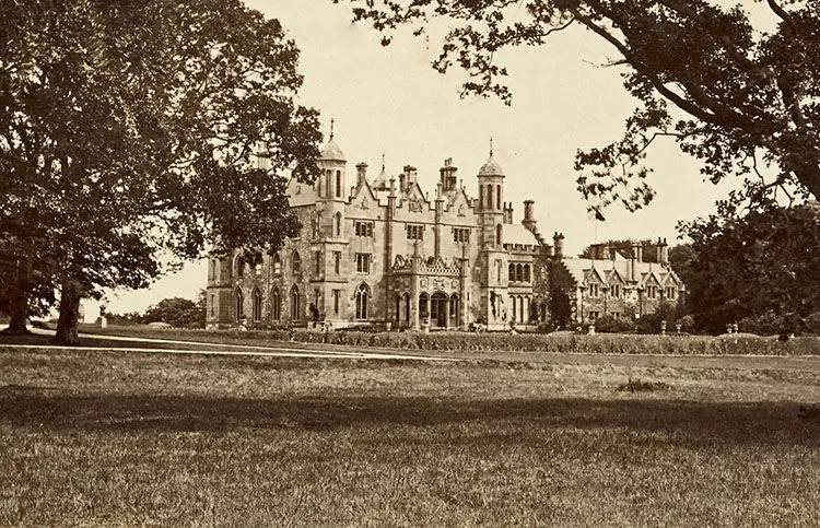
The current Earls of Antrim have their seat at nearby Glenarm Castle in Cushendall.

Glenarm Castle home to the earls of antrim
Glenarm Castle, Cushendall

Dunluce Castle is still owned by the MacDonnell family, however, is now in the care of the Northern Ireland Environment Agency, as one of its monuments under state care since 1928

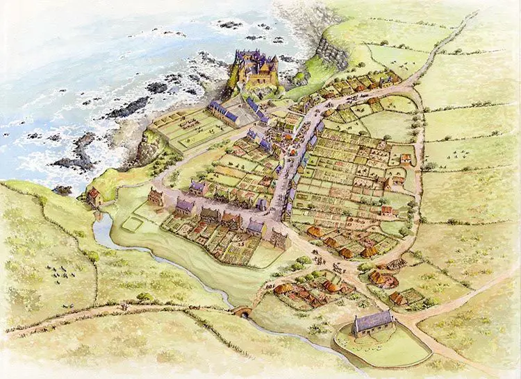
History of Dunluce Town

The rich history of Dunluce castle is only one element of your visit to the area. Following major archaeological excavations, significant remains of the “lost town of Dunluce”, which was razed to the ground in the Irish uprising of 1641 were found.

Artists impression of Dunluce Castle and old Dunluce Town
Artist’s Impression of Old Dunluce Town and Dunluce Castle

Lying immediately next to the Castle, the long abandoned Dunluce town (or Dún Libhse in Irish) was built between 1600 and 1610 by Randall MacDonnell, the first Earl of Antrim, and as such pre-dates the official Plantation of Ulster. The small town is said to have had the most revolutionary housing in Europe when it was built, this included indoor toilets which had only started to be introduced around Europe at the time, cobbled streets and a complex street network based on a grid system. 95% of the town is still to be discovered.

Visit Dunluce Castle

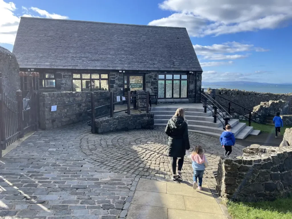
The Visitor Centre

Even though there are plenty of attractions in Northern Ireland, this is one of our favourite destinations. Dunluce is a great place to enjoy the history of Ireland and to take in the beautiful scenery of the land. 

Opening Times

February to November: Daily 9.30am to 5pm. 

December & January: Daily 9.30am to 4pm. 

Last admission 30 minutes before closing.

Dunluce Castle Tickets

Adult (18+ years) £6.00 per ticket

Child (5 – 17 years) £4.00 per ticket

Children Under 5 Free

Concession*£4.50 per ticketFamily*£18.00 per ticket

Group rate available for 15 adults (+1 tour guide free) £4.50pp

Annual rates are also available; Adult – £12, Child 5 -17- £8.00, Concession* – £9.00 & Family Pack* – £36.00 

*Concession – 65+, Students (18+with official student card), disabled, unemployed citizens
*Family – Up to 5 people (including up to 3 adults)

It should be noted that as this is under the protectorate of the NI Government National Trust cards are not accepted.

It is a fantastic place to listen to stories from the Game of Thrones, Led Zeppelin, and C.S Lewis. It is excellent for visitors of all ages, we recently took our 5-year-old and his friend who had a blast….although be wary of taking them down to the Mermaids cave, its a lot of steps to carry a 5 year old back up.

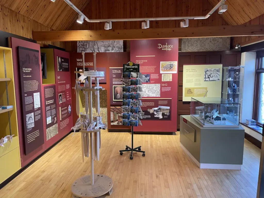
Inside the Visitor Centre

You can enjoy the audiovisual presentation, friendly greetings, and a walk around the dramatic history of the castle. You get the chance to learn about its fascinating history. 

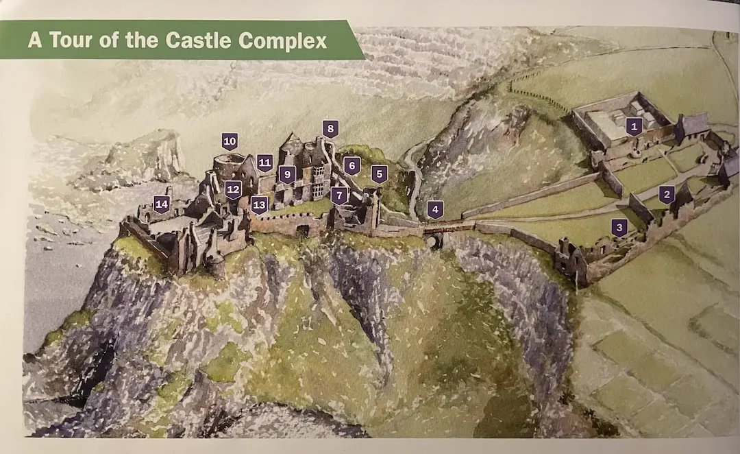
There is a trail that takes around 40 minutes to complete, this can be done with the assistance of guides or through one of the multilingual headsets. You can now even download an app tour to your phone.

The Dunluce Castle Tour Guide

Views from and around the castle are stunning. The Ocean vista which stretches as far as your eyes can see and the cliffs are equally beautiful. On a clear day, you can see the Scottish Island of Islay (Famous for its whisky) and Inishtrahull Lighthouse, off the Donegal Coast. If you want a bird’s eye view, you can stand on an existing tower.

Tour of the Castle

The Stables & Lodgings

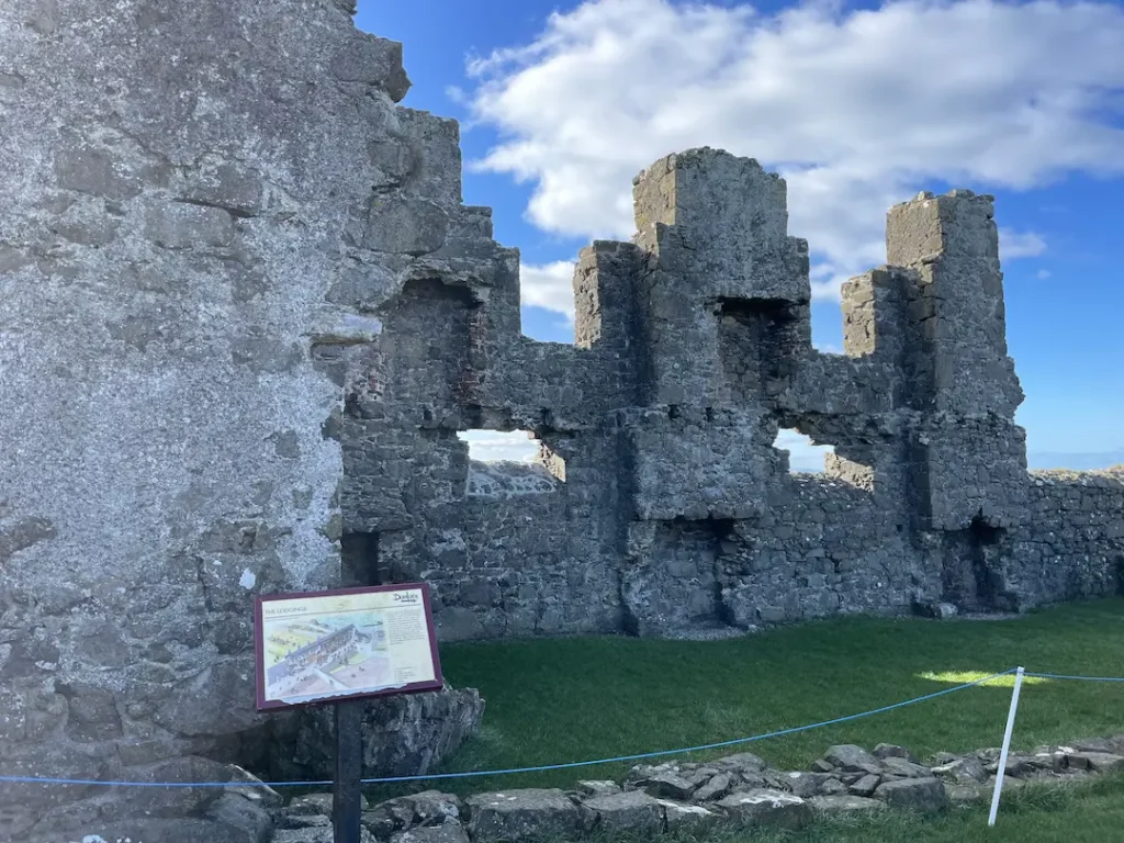
Dunluce Castle Lodgings

Built to house the lords horses, visitors and staff, this building appears to have been divided into various rooms of different sizes., each containing a window and fireplace. The inner wall has collapsed giving you a view into the ground floor. The north end was gallery rom with a balcony overlooking what would have been the castles private gardens and bowling green. These are still visible through the windows. This area also home t the stone merchants houses

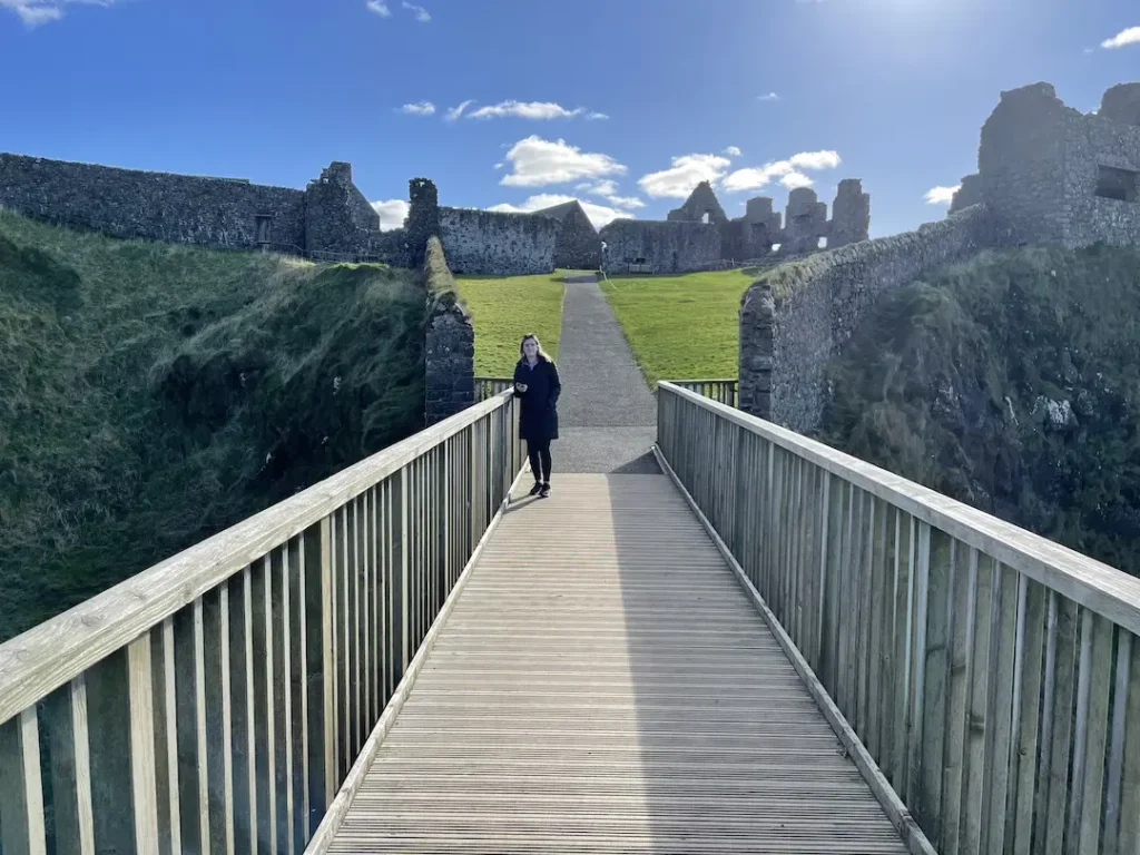
The Bridge

The Bridge at Dunluce Castle From The Gatehouse

While the present castle is accesses via a wooden bridge, which sits onto of the masonry arch built in the 17th century, there was originally a wooden drawbridge. When you cross you can get amazing views of the dramatic coastal cliffs and on the eastern side can be seen natural sea cave that boats could enter on calm days. This is the only natural harbour.

The Gatehouse

The Gatehouse at Dunluce Castle from the bRIDGE
The Gatehouse

The imposing gatehouse was originally built by the MacQuillans, then modified substantially by the MacDonnells in the mid 1500s in the Scottish Baronial Style with two large drum towers. You can see an etching on a stone of a medieval Scottish galley (ship), which serves as a reminder of the sea connection with Scotland and Ulster.

The Manor House

The Manor House Dunluce

The Manor is the main residence of the Lords entire family. The remains at Dunluce are an excellent example of a Jacobean mansion that was built by Randal MacDonnell in around 1620. There is staircase that would have lead to first floor and the MacDonnells private quarters would have been. From excavations it is believed that this grand house was built on the site of an earlier building probably used by the MacQuillans.

The View From The Manor House Main Window

Two Towers

From every angle the castle is dominated by the two towers on the eastern side of the building. Both towers were built at the same time by the MacQuillans. They were built in the Irish style with a ground floor roof vault. You can still see the imprint of the wicker thatch that was used during the construction of the vault. Both towers were upgraded throughout the years to reflect their purpose, defending the castle, with the MacDonnells adding gun loops.

The Kitchen and Inner Ward

Under the castle, there is a hidden cave. Even though you cannot get into it, it is a sight to behold.

Some local companies offer guided tours of Dunluce, here are just some of them.

Myths & Legends

Legend has it that at some point, part of the castle kitchens fell into the sea one stormy night. It says that the wife of the castle’s owner did not want to keep living there after this and only a boy survived from the kitchen staff. The legend does not seem to be true since the castle’s kitchen is still in place. It is possible to see the entryway fireplace and oven. The north wall of the palace collapsed and fell into the sea in the 18th century. The other walls are still intact.

The Kitchens

In 1534, a child in the McQuillan family was said to have seen the figure of a woman in a white dress on the edge of the cliff. The woman is supposed to have been looking out at the ocean. The little boy reported that he saw the woman disappear into the wind. No one believed him primarily because he and his elder sibling went out the next night and saw nothing.

In the early 1550s, something similar happened. People claimed that they saw a woman in a white dress walking down the to shore close to the castle. There were numerous claims that the castle was haunted until one time when a member of the McQuillan family walked to the beach and attempted to speak to the ghost. The woman was never seen again.

Dunluce Castle on Film and TV

If you have watched the favourite HBO series Game of Thrones, you may be interested in touring the beautiful, rugged location on the causeway coast.

The beautiful ruins of the castle appeared as the exterior of the Iron Island stronghold which is the seat of the House of Grejoy. Some residents of the castle include; Yara Grejoy, Balon Grejoy, and Theo Grejoy. You can see it in seasons two and six.

The Castle was also mentioned by admirers of ‘The Chronicles of Narnia.’ Many viewers believe the castle to be the inspiration for Cair Paravel, the seat of the kings and queens of Narnia.

The HBO Series has attracted visitors from all over the world more recently; however, the castle has been a tourist attraction for centuries. The landscape has always been an inspiration for creatives of romantic plotlines. As the poet Robinson Jeffers put it,

‘No spot of earth where men have so fiercely for ages of time

Fought and survived and cancelled each other,

Pict and Gael and Dane, McQuillan, Clandonnel, O’Neill,

Savages, the Scot, the Norman, the English…’

How to Get To Dunluce Castle

Dunluce Castle is only around 2.5 miles from Portrush along the Causeway Coastal Route (A2). Therefore, its quite easy to get there in many ways.

Getting there by Car.

If you are visiting the Dunluce as part of a more extended day trip, then taking the car is the easiest option. Just head east past Royal Portrush Golf Club, along the A2 (Sign posted for Bushmills/Ballycastle). There is a small car park a short walk from the Castle, next to the Wee Cottage Cafe.

Coming from Belfast or Dublin in the car you have two options, the quickest is to follow the A26 north from Belfast, turning off at Portrush Road Roundabout, in Ballymoney, onto the B62 (Ballybogey Road) signposted Portrush/Bushmills. After 9.5 miles turn right (east) at the Royal Court Hotel onto the A2/Causeway Coastal Route. Follow this road for a mile.

NOTE: do not trust your SatNav….a number of times we have been taken along singletrack back roads, where the only views are high hedges, sheep, cows and grass!

The second option is to follow the Causeway Coastal Route along the North Antrim Coast. This is one of the most excellent driving routes in the world.

The address is

87 dunluce road

Portrush

County Antrim

BT57 8UY

Northern ireland United Kingdom

By Public Transport

From Portrush, you can take the Translink 172 or 402 (Ballycastle) bus from Dunluce Avenue. It takes around 15 minutes and drives along the coast. You can find the timetable here.((insert the timetable))

If you are coming up from Belfast or Dublin, then one of the simplest ways to get to the castle is by taking a train. You can take a train from Dublin Connolly Station (The EnterpriseChanging at Belfast Lanyon Place . The train from Dublin to Belfast is around 2 hours and from Belfast to Portrush is approximately 1.5 hours.

You will then have to either get the bus from Dunluce Avenue or take one of the plenty of Taxis just outside the station.

Even though the castle is not accessible by wheelchair, the surrounding site is beautiful. The coastline and surrounding scenery are stunning. There is a car park and a visitor centre on-site.

On Foot

You can, of course, walk from Portrush to Dunluce Castle. The walk takes you along the East Strand Beach, past the enormous dunes that lead up to Royal Portrush Golf Club, to Whiterocks Beach, so named after the stunning limestone cliffs. You will then emerge on the road near the Royal Court Hotel onto the A2 Causeway Coastal Route. From here walk along the footpath, stopping to take in the views of Portrush, The Skerries and Dunluce Castle from Magheracross View Point. You will be able to see the Castle a short walk further on.

You can see details of a longer walk from Portrush to Bushmills on the Walk NI website here

Let us know what you think of this guide, have you been and know of something that could be added, or are you going and want to know more?

Leave a comment below and will get right back to you, or contact us on social media.

A Guide to Carrick A Rede RopeBridge

Carrick-a-rede-rope-bridge-in-northern-ireland-close-to-Portrush-compressor

Carrick-A-Rede Ropebridge

Carrick-a-rede is a famous footbridge located near Portrush on the North Coast of Northern Ireland.

The name Carrick-a-rede is from the Irish Carraig a’ Ráid meaning “rock of the casting”.

The footbridge connects a tiny rock island called Carrick-a-rede to the mainland, therefore, earning the name Carrick-a-rede footbridge.

Carrick a rede has had a bridge for over 350 years ago, initially built at the start of each fishing season with slates of wood strung up with just one guide rope.

No one lives on the island; however, there is a small bothy and workshop previously used by the local salmon fishermen who used it for shelter and to land their catch. For many years the sole function of the bridge was to transport men on and off until the salmon population dwindled to a point whereby it became unviable to make a living from fishing. Sadly 2002 was the last season (which runs from June to September) that was commercially fished, where the annual catch was just over 300, which was the average catch per day in the 1960s.

The current bridge is now owned by the National Trust and was built by Heyn Construction in 2008 at a cost of £16,000 ($21,000). Whereas the original bridges were made of rope and wood, the current bridge is built of steel wires ropes and Douglas Fir wooden slats along the path. In terms of dimensions, the new bridge is 66 ft long and is suspended 100 ft above crashing waves and rocks. The bridge can support up to 10 tonnes of weight…..more than enough to support the 8 visitors limit that the wardens allow at any one time.

If the weather is turbulent, the gates will be closed off for safety purposes, therefore, before visiting the area check on the weather. You can also check on the dedicated Twitter (@NTCarrickarede) site for the most up to date information. Most tourists tend to avoid it during the rainy and windy days, so it may the best time to go if you want it all to yourself.

From speaking to the local guides, occasionally visitors go over and they are afraid to come back across the bridge due to the wind swaying the bridge. Therefore, their only option is to be ferried back from the island to the mainland via a boat. There are the people who land on the island using helicopters, but this is a rare occurrence happening once or twice in a year.

If you want to get an alternative view of the Rope Bridge, there are sailing and kayaking tours that will take you under the bridge. When the tide is unusually low, you can even walk under the bridge.

These tours are ideal for exploring the rarely seen caves, which were made famous in the HBO series Game of Thrones.

Sunset at Carrick-a-Rede Rope Bridge in County Antrim this week. Photo by Tim Johnston. pic.twitter.com/LO2t9O4Ogx

— Barra Best (@barrabest) 4 May 2017


The journey to the bridge is not ideal for people with mobility issues, not because of the bridge itself, but the path leading up to the bridge is essentially an uneven gravel path…and then there are the steps at the end.

If you can master the courage to descend down the steps and walk across the bridge, which only takes a few minutes, you will be rewarded with spectacular views. From the island, you will be able to see Rathlin island, Ireland’s only inhabited offshore Island, and even Scotland. You will also get to enjoy the flora found on the island and breathtaking views of a clear blue sea.

When you arrive in the area, there is a car park, and if you feel a bit chilly after hiking your way to and from the bridge, then there is a tea room where you can have some of the best tea in that part of Ireland.

How Much Does it Cost?

Carrick-a-rede is open all year round and is free for those who just want to walk along the coastal path see the bridge close up or, however, if you’re going to cross onto the island you’ll need to purchase a ticket.

As the bridge can get very busy at times (it had over 450000 visitors last year) the National Trust has started to operate an online timed ticketing service. Visitors are able to purchase tickets from 09.30, with the latest ticket sale at 18.15 during peak season.

Tickets cost

Adult Ticket £9.00

Child Ticket £4.50

Family Ticket £22.50 (2 adults and up to 3 kids)

National Trust Members and Touring Pass holder are free…but still have to book.

You can book online here 

Carrick-a-Rede on Film and Tv

The HBO Fantasy series based on Goerge R. R. Martins Novels, Game of Thrones, has filmed a number of their scenes on the island. Most of the scenes are in the second season.

Carrick a rede was the land referred to as Storms End located in Stormlands. The land had one of the strongest castles in the realm and was under the control of the House Baratheon. In the game of thrones, the producers made storms end the regional capital. Carrick at rede island featured in season 2 episodes below.

Episode 3: What is dead may never die – this is when Catelyn Stark arrives in Baratheon’s camp during a tournament that was won by Brienne of Tarth. Later Baratheon shows off his army of 100,000 strong men willing to fight to the death for him. You can see the Larrybane Quarry next to Carrick-a-rede and the making of that episode here

Episode 4: Garden of bones – this is when Little finger arrives at Renley Baratheon’s camp as a political envoy to try and gain his trust

  • King Stannis also arrives at stormlands and heads to Renley’s Baratheon’s camp to ask Renley to relinquish his claim to the throne and serve him
  • Ser Davos takes the red priestess via boat to some caves near Renleys camp where she gives birth to a shadow creature

Episode 5: The Ghost of Harrenhal – this is when Renley Baratheon is killed by the shadow creature born by the high priestess and his army divides after his death.

Geology

Carrick A Rede island is one of the best examples of a volcanic plug in the United Kingdom and Ireland. Erosion by the Irish Sea/Sea of Moyle has exposed the neck of this old volcano.

The violence of the molten rock punching its way through the soft chalk 60 million years ago can be seen through the presence of geological evidence such as Tuff, Explosion breccias, explosion bobs and grey volcanic ash in the layers of the rock of the Island and surrounding.

Along the whole North Antrim coast, that forms much of the Antrim plateau, the characteristic Ulster Chalk is topped by basalt cliffs. At Carrickarede, the ancient volcanic pipe has left dolerite, a more robust rock than basalt, which erodes more slowly. Behind the dolerite, to the south, the vent is filled with pyroclastic rocks that break down more easily, mostly a coarse tuff agglomerate. The combination of the hard rock out front and the softer rock behind, with long-term erosion by the waves, has eventually left this small island.

The island has Large caves which can be seen best during low tide. It is assumed that at some point the caves were used to serve as boat builders homes. They also provided shelter for fishing vessels during stormy weather.

The natural sea surrounding the area has blue waters that sometimes turn green making it an area of particular interest. Unique flora and fauna cover the island. It has a lot of bird colonies that play an essential role in the area’s ecology. Example, Razorbills are birds that live the island and only come back when it is time to mate and nest. The cliffs of the island are covered with birdsfoot trefoil and thrifts that give the island a paradise-like look.

How to Get To Carrick A Rede

There are several routes you can take to get to the National Trust Carrick a rede rope bridge. It’s important to note that the bridge opens at 9:30 am, and the ticket sales stop at 5:15 in the afternoon that’s 45 minutes before the closing time. In some circumstances, the closing time may be changed due to tourist traffic. In the summer the closing time is extended to 7:00 pm because it is the peak season while in the winter the closing time can be as early as 3 in the afternoon, this can be due to the severe weather conditions or lack of tourists wanting to cross the bridge.

Carrick a rede is located only 15 miles (around 20 minutes) from Portrush and 60 miles (around an hour) to the north of Belfast. For ease, most tourists are guided to the area by a tour guide at a small fee.

Public Transport

Bus – visitors who are not familiar with the area can head out on the bus from Dunluce Avenue and take the 402(a) or 172 also known as the causeway Rambler. A timetable for this can be found here. From Belfast, visitors can take the 218 Goldline Bus (or the train as they stop in the same place) to Coleraine and then get the 402 or 172 Bus as above.

Car – Carrick-a-rede is only a short 15 mile or 20-25 minute drive along the stunning Causeway Coastal Route (A2)from Portrush, passing the Giants Causeway, The Dark Hedges and Dunluce Castle. Driving from Belfast will take around 1 hour 10 minutes depending on the traffic to cover the 60 miles. First, you will have to take the M2 route, then switch on to the A26 until Cloughmills and then switch over to the A44 (Drones road which switches onto Maghermore in Capecastle) to arrive at the park.

If you have a bit more time, then we recommend you take the Causeway Coastal Route from Belfast to Portrush. This is one of the best driving routes in the world. You can find out more about it here.

Airport

The fastest way to access Carrick-a-rede is by using one of the airports around Belfast.

Belfast International Airport (BFS) – this is an international airport approximately 20 miles away from the Belfast city centre. From the airport take the 300 Airport Express Bus to Belfast City centre, the journey takes about 40 minutes. You can also hire a taxi.

George Best Belfast City Airport (BHD) – this is situated two miles away from the Belfast city centre. It is a relatively small airport that deals with domestic flights. From the Airport take a cab to the Belfast city centre where you can choose one of the causeway rambler buses.

From Dublin

The best-known way to get to the bridge from Dublin is by driving yourself, it will take around 3 and a half hours from the city centre. If you don’t fancy driving or want to take the opportunity to see as much of the scenery as possible, then it is best to take one of the many tours that operate daily from Dublin.

You can find out more details about them here

Well, that’s it, our guide to Carrick-a-rede Ropebridge, we hope you find it useful in planning your trip. If you have already been let us know how it went and if there is anything that we have missed. We will continue to update this page as we get more information.

Guide To The Dark Hedges

Dark-Hedges-Visit-Portrush-Northern-Ireland-compressor

The Guide to the Dark Hedges

The Dark Hedges, one of the most popular attractions in Northern Ireland, is a beautiful row of beach trees that have been made famous by appearances in TV shows and films such as Game of Thrones. The Dark Hedges is a favourite stop on the Causeway Coastal Route road trip, running along Ireland’s North Coast from Belfast to Derry.

In this guide, we’re going to look at everything you need to know to get the most out of your visit to the Dark Hedges including how to get there, where to park, how to avoid the crowds, and places to stay nearby.

Table of Contents

What is the Dark Hedges?

The Dark Hedges is an avenue of mature beech trees,  planted around 1775 by James Stuart to frame the avenue leading to his home, Gracehill House. The trees, originally around 150, line both sides of Bregagh Road, forming an imposing tunnel along the roadway.

Today, the Dark Hedges still lead up to the current gates of Gracehill House.

Gracehill House itself is privately owned and operates as a bar & restaurant, wedding venue, and golf course. So you can visit the estate for a drink, meal, or play a round of golf while on your trip.

Game of Thrones (GoT) fans should visit Gracehill House during opening hours to see one of the 10 GoT-themed doors, based on the 6th season of the show. The door at Gracehill was carved from one of the Dark Hedges trees that fell during Storm Gertrude in 2016.

The 250-year-old trees, which are very atmospheric. The stunning organic tunnel of tree limbs crisscrossing the road, made famous by HBOs Game of Thrones, draws thousands of visitors from all around the world.  Sadly, many of the trees have been lost due to storms and damage (part of the reason the road was closed to traffic in 2017 was due to the damage caused), with just over 90 of the original 150 trees are still standing.

Why are they called the Dark Hedges?

From our research, it seems unclear when or why the name of the Dark Hedges was given; however, there are two likely explanations. First, the most obvious answer is that the massive trees block most of the light, resulting in a “dark” tunnel that looks like a hedge.

The other explanation is a bit eerie. Local legend has it that the hedges are haunted by a ghost known as the Grey Lady, who haunts the trees, flitting from one to another before always disappearing at the last beech tree. As the story goes that on Halloween, she is joined by spirits from a nearby ancient graveyard!

Whatever the reason for it, we are sure you will agree it’s a very appropriate name for this stunning location!

Legend has it that a Grey Lady Walks the Dark Hedges

Where is the Dark Hedges Located?

The Dark Hedges is found in County Antrim in Northern Ireland between the villages of Armoy and Stranocum, around a 20-minute drive from Portrush. They can be located on the Bregagh Road (about half a mile long), between the Ballykenver road to the south and the Ballinlea Road to the north, near The Hedges Hotel

The Hedges are around 50 miles, or an hours drive, northwest of Belfast and 150 miles, or approximately 3 hours, drive from Dublin.

How to Get to the Dark Hedges?

There are many ways to get to the Dark Hedges:  you can drive yourself, you can take a tour, or you can take public transport.

Driving to the Dark Hedges

This is probably the quickest way to get there, giving you flexibility in terms of how long you spend here and where else you can go  Its about a 20-minute drive from Portrush or if you are coming from Belfast about a 1-hour. There is free car parking a short walk from the Hedges, as the road is now closed to traffic (see parking section below).

You can still see evidence of root damage and lots of car tracks in the mud which makes us sad (and a little angry).

Note that high fines (up to £1,000) may be given to motorists attempting to drive or park along the Dark Hedges since its closure.

If you are driving up from Belfast or Dublin, we recommend that you come along the Causeway Coastal Route, along the A2, as it has some of the most breathtaking driving in the world.

Where to Park for the Dark Hedges?

This is not the view you came to see

There is a large free visitor car park beside The Hedges Hotel located just off Ballinlea Road. This is an easy two-minute walk from the north end of the Dark Hedges, along with the marked path.

Address of Parking:

139A Ballinlea Road, Stranocum, Ballymoney BT53 8PX

GPS Coordinates of Parking:  

55°08’17.9″N 6°23’01.4″W

Please don’t try to park at the entrance to the Bregagh Road, as not only can this damage the tree roots that are close to the surface, but more importantly it will also ruin everyone’s photos.

Dark Hedges by Day Tour

If you don’t have a car or maybe want to just sit back and let someone else do the driving, many guided day tour options include a stop at the Dark Hedges.

Most of the tours stop at many of the other amazing places near Portrush and along the Causeway Coastal Route, such as the Giant’s Causeway, Carrick-a-rede Rope bridge and possibly for those who like a tiple the Bushmills distillery.

You will find many tours that leave from both Belfast and Dublin including tours offered through GetYourGuide (see 20+ options here) and  Viator (you can explore 40+ tour options here).

However, we have listed some of the local companies in the Tours Section below.

Giant Tours Ireland

Dark Hedges by Public Transport

While it often decried by those who live here ( I’ve never been anywhere that this isn’t true) is also possible to get to the Dark Hedges by public transport from Portrush, Belfast and Dublin.  

Although there is no bus stop or train station at the Dark Hedges itself, there are some within walking distance.

Translink has a journey planner that is very good and can be found here

Dark Hedges By Public Bus

From Portrush it’s about an hour and a half, depending on connections, to get to the Dark Hedges. This involves getting a bus (or train) into Coleraine and from there getting the Ballycastle Bus (at time of writing the 171 Bus) and getting off at Moss Side. Moss Side is about half a mile walk from the Hedges.

From Belfast, it’s around 2 hours to 2.5 hours by bus to get to the Dark Hedges. There are a few ways you can do this, but one way is to take the Translink Goldline 218 bus (or train and the bus and train station cohabit) from Belfast to Coleraine and then change to the 171 (Ballycastle) bus at Coleraine as above.

If you are stuck, just ask for the stop nearest the Dark Hedges / The Hedges Hotel at the station or on the bus, as the Bus drivers are generally accommodating on this route.

Dark Hedges By Train

Getting to the Dark Hedges by train you have two options the first is as above get the train to Coleraine (see above), or you can take the train from Belfast to Ballymoney which takes about an hour. From there you will need to make a 10-minute taxi ride from the Ballymoney train station to reach the Dark Hedges, or take a short walk into the town and get the 178 (Ballycastle) bus and get off at Clintyfinnan stop (you’ll also see the Dark Hedges Experience at this stop.

Dark Hedges Map

This map is a quick overview of the Dark Hedges, including where the car park and the main stretch of the road are. For reference, the red line is around half a mile long.

The Red Line Shows the Length of the Dark Hedges

How much does it cost?

The Dark Hedges is currently free to park and visit. See parking information above for where you can legally park for free.

The site was not developed as a tourist destination and, until before it became famous through Game Of Thrones, it was just a short stretch of a typical country public road. There is free parking next to The Hedges Hotel and a nice path leading to the Dark Hedges.

Causeway Council has a small tourist information hut at the beginning of the path with local visitor information near the parking area.

Be warned, there are no tourist facilities at the actual Dark Hedges (water, toilets, etc.). However, the two restaurants located within a few minutes of the Dark Hedges are excellent.

The Scullery Bar & Restaurant at The Hedges Hotel serves breakfast, lunch, and dinner and is open to both hotel guests and visitors.

Gracehill House also has a bar and restaurant, the BellTower Restaurant, which serves lunch, dinner, bar snacks, coffee, and drinks.

The Dark Hedges in TV & Film

The show that made the Dark Hedges famous was of course Game of Thrones, the TV adaptation of George R. R. Martins bets selling novels. In the show, the Dark Hedges was used as “The Kingsroad“.

This Kings Road runs across Westeros, from Kings Landing in the south to “The Wall” in the north.

The Dark Hedges appears as the Kings Road in the Season 2 opening episode “The North Remembers“. In the episode, Arya Stark can be seen escaping from Kings Landing in a caravan, that travels through the Dark Hedges along the “Kingsroad”.

The Dark Hedge has also appeared in films such as Transformers: The Last Knight in a scene where the magician, Merlin, is riding on a horse through the trees.

The Kings Road from Season 2

Tours Visiting the Dark Hedges

If you aren’t driving yourself in Northern Ireland, then you have many tour options, both group and private tours, for visiting the Dark Hedges, both from Belfast and Dublin.

How to Avoid the Crowds at the Dark Hedges

With the increasing fame from the Game of Thrones series, the Dark Hedges has become an incredibly popular place to visit. It is also one of the most photographed locations in Northern Ireland.

Sadly, with the fame from its GoT association, it has also become overcrowded at times. Therefore, it can be challenging to have this place to yourself as many people visit throughout the day, especially in the busy summer months and bank holiday weekends.

But you can definitely plan your time, so you are here when fewer tourists are around. Here are our tips

Visit off-season between October and March. Summer is the busiest travel time, and you’ll find fewer travellers here at other times of the year….you’ll also get some of the best pictures with low light, snow and mist adding to the already fantastic place.

Avoid holidays and long weekends. These are hectic times and are always very very busy.

Arrive early or come late. Our (and most photographers) favourite time is around sunrise and sunset. Sunrise is particularly suitable as not many people will be up and it is generally not the first stop on many tours.

Walk to the furthest end from the car park/Garcehill House. Every time we have been, we have found that most folks are pretty lazy and will just get some pictures from the north end then jump back in the car/bus. So that generally means the south side is usually less busy, and the little bends and hills, block out the people on the other end.

Ireland is Wet and Cold

This is Ireland, it rains and is not known for its tropical weather…..however, youd be surprised how many are scared off by a little rain or cold. Bad weather will keep some visitors away, mainly rainfall. Pouring rain is going to make photography difficult so maybe not worth the visit, but a little drizzle can really add to the atmosphere.

Be patient.

If there are a large group of people, possibly from a bus tour, just give it 10 minutes until they leave. Most people and tours don’t spend more than 15 minutes here, which is a shame.

Where to Stay Near the Dark Hedges

The Hedges Hotel is the closest hotel to the Dark Hedges, just a few minutes walk from the Dark Hedges.  If you want to be as close as possible, then this is definitely the place to stay. The Hedges Hotel makes it easy and convenient to visit the Dark Hedges when you want…or more importantly without the crowds! Ideal for those looking to get that fantastic shot.

Here are some more options within a 15-minute drive. However, we would recommend that you base yourself in Portrush, as it is the perfect place to explore other sites and sounds.

Gardenvale Manor House B&B – Beautiful well-rated 18th-century manor house set within lovely gardens. Great place for a romantic stay. Just a 5-minute drive from the Dark Hedges.

Limepark – Luxury traditional holiday cottages with kitchens and all the amenities on a restored Georgian farm. Cottages vary in size and can sleep 2 to 6 persons. Great for those looking an upscale self-catering option. About a 6-minute drive from the Dark Hedges.

The Armada Inn – A well-rated bed-and-breakfast with a well-rated restaurant. Just a 5-minute drive from the Dark Hedges.

Mill House Studio Apartment – A modern studio apartment in a tranquil setting on the site of an old flax mill. A good option for families. A 4-minute drive from the Dark Hedges.

Dark Hedges Cottage – A well-rated 2-bedroom holiday cottage within a 6-minute drive of the Dark Hedges. Another good option for families.

Marine Hotel Ballycastle – A casual 3-star hotel with a restaurant and seafront views in Ballycastle. Located a 2-minute walk from the beach and a 14-minute drive to the Dark Hedges. Ballycastle is a good option for those travelling by public bus and is also where you can get the ferry to Rathlin Island.

Hostels

The closest hostels are Bushmills Youth Hostel (20-minute drive), Sheep Island View Hostel (14-minute drive) or Portrush Youth Hostel (25-Minute drive)

Campsites

The closest campsite to the Dark Hedges is Charlies Hideaway (5-minute drive), although note this site is for Camping and Caravanning Club members only. Other nearby campgrounds are Fairhead Caravan Park (15 minutes) and Ballyness Caravan Park (20 minutes away).

We hope you find our guide to visiting the Dark Hedges in Northern Ireland useful.

Wed love to hear if you have been to the Dark Hedges? If so, what was the experience like for you?

As always, feel free to ask us any questions you may have about the Dark Hedges or things to do near Portrush by Tagging us on social media or emailing us.

Keep Up To Date With Visit Portrush

Keep upto date with all that is going on in Portrush direct to your inbox

Visit pORTRUSH

About

  • Portrush
  • About Us
  • Blog
  • Contact Us


Twitter


Facebook


Instagram


Youtube


Pinterest

© 2019 All rights reserved

Taxis

Welcome to Portrush, a picturesque coastal town that captivates visitors with its stunning scenery, vibrant atmosphere, and rich cultural heritage. As you explore the town and its surrounding attractions, you may need reliable transportation to navigate its charming streets and reach your desired destinations. That’s where the exceptional taxi services of Portrush come into play.

In this article, we will delve into the world of taxi companies in Portrush, highlighting the best options available to ensure your travel experiences are seamless, convenient, and comfortable. Whether you’re a local resident needing a quick ride, a tourist eager to explore the town’s hidden gems, or a traveller arriving at the nearby airport or train station, Portrush’s taxi services are ready to cater to your transportation needs.

From well-maintained vehicles and courteous drivers to prompt and reliable service, the taxi companies in Portrush prioritize customer satisfaction and strive to make your journeys pleasant and stress-free. Whether you’re looking for a short trip within the town, a scenic drive along the stunning coastline, or a convenient transfer to nearby attractions, these taxi companies are dedicated to ensuring you reach your destination safely and efficiently.

Join us as we explore the top taxi companies in Portrush, uncover their unique features, and provide you with all the essential information you need to make informed decisions about your transportation needs. We will showcase their commitment to exceptional service, affordability, and local knowledge, allowing you to sit back, relax, and enjoy the sights and sounds of Portrush without any worries about logistics.

So, whether you’re planning a visit to Portrush or are a resident in search of reliable transportation options, let us guide you through the diverse and reliable taxi services available in this captivating coastal town. Get ready to embark on hassle-free journeys and experience the convenience and comfort that Portrush’s top taxi companies have to offer.

Taxis in Portrush

S & C Taxis
Tel: 028 7082 1008
84 Crocknamack Road, Portrush, County Antrim BT56 8JW

Sam’s Cabs
Tel: 028 7082 4163
38 Parker Avenue, Portrush, County Antrim BT56 8JZ

Andy Brown Taxis
Tel: 028 7082 2223
5 Dunluce Street, Portrush, County Antrim BT56 8DN

McLean Cabs
Tel: 028 7082 2700
30 Carneybaun Drive, Portrush, County Antrim BT56 8JA

North West Taxis
Tel: 028 7082 4446
3 Eglinton Street, Portrush, County Antrim BT56 8DX

Top Taxis
Tel: 07955 359889
22 Ballylagan Road, Portrush, Coleraine, County Londonderry BT52 2PQ

Historic Buildings

Castles

Dunluce Castle
Medieval & 17th century castle
Open to the public, 3 miles east of Portrush
87 Dunluce Road, Bushmills, BT57 8UY
Tel: 028 2073 1938

Dunseverick Castle
Older ruinous castle, protected by the National Trust
8 miles east of Portrush
Causeway Road, Dunseverick

Mussenden Temple

Mussenden Temple
Built 1785 by Frederick Augustus Hervey, as a memorial for his cousin
Protected by the National Trust & features magnificent views
12 miles east of Portrush, near Castlerock
Mussenden Temple and Downhill Demesne, Mussenden Road, Castlerock
Tel: 028 2073 1582

Church buildings

St. Patrick’s RC Church
Causeway Street, Portrush
B Listed

Dr.Adam Clarke Memorial Methodist Church
Causeway Street / Eglinton Street, Portrush
B Listed

Presbyterian Church
Main Street / Eglinton Street, Portrush
B Listed

Reformed Presbyterian Church
Glenmanus Road, Portrush
B Listed

Holy Trinity Parish Church
Main Street, Portrush
B+ Listed

Monuments

Fountain
The Arcadia, Causeway Street,Portrush

B Listed

War Memorial
Kerr Street / Mark Street junction,Portrush

B1 Listed

Other Buildings

Northern Bank
Main Street Portrush
B Listed

Factory (Morelli’s Ice Cream)
Eglinton Lane (rear of 4 Dunluce Avenue) Portrush, BT56 8BN
Not Listed

Seabank Hall, Bath Terrace, Portrush
B1 Listed

Town Hall, Mark Street, Portrush
B1 Listed

Railway building
Traks Nightclub, Eglinton Street,Portrush
B1 Listed

Store, Antrim House, 73 Main Street Portrush, BT56 8BN
B2 Listed

Hotel buildings

Northern Counties Hotel
Main Street, Portrush

The Windsor Guest House
67-69 Main Street, Portrush
B Listed

Residential buildings

6-26, 10, 11 Kerr Street, Portrush
Not Listed

29 Kerr Street, Portrush
B Listed

29, 30, 31, 36, 37, 38 Kerr Street, Portrush
B1 Listed

6-8 Bath Street, Portrush
B2 Listed

71 Bath Street, Portrush
B1 Listed

Craig Vara House, 5 Craig Vara Terrace, Portrush
B2 Listed

Manse, Main Street, Portrush
B Listed

61 Dhu Varren, Portrush, BT56 8LN
Not Listed

Co. Antrim

Retail buildings

23-25, 27 Main Street, Portrush
B1 Listed

59, 61 Main Street, Portrush
B2 Listed

63, 65 Main Street, Portrush
B Listed

Post Office, Causeway Street, Portrush
B1 Listed

Churches

Ballywillan Presbyterian Church
131 Atlantic Road, Portrush, BT56 8PB
Tel: 028 7082 2612
www.ballywillanpci.org
Sunday services 9:30am & 11:30am

Dunluce Christian Fellowship
17 Dunluce Ave, Portrush, BT56
Tel: 07784 806 654
www.dunlucechristianfellowship.com
Sunday services 10am, 11:30am & 6pm

Glenmanus Reformed Presbyterian Church
23-25 Portstewart Road, Portrush, BT56 8EH
Tel: 028 1234 5678
www.rpc.org
Sunday services 11:30am & 7pm

Holy Trinity Church of Ireland
62 Main Street, Portrush, BT56 8BN
Tel: 028 7082 4024
www.holytrinityportrush.org.uk
Sunday services 8:30am, 11am & 6:30pm

Portrush Baptist Church
11, Portstewart Road, Portrush, County Antrim, BT56 8EG
028 7032 9911
www.portrushbaptistchurch.org
Sunday services 11am & 7pm

Portrush Methodist Church
2 Corrstown Park, Portrush, BT56
028 7082 2255
www.irishmethodist.org
Sunday service 10:30am (& 8pm July & August)

Portrush Pentecostal Church
13 Hamilton Place, Portrush, BT56 8DB
Tel: 028 7082 5376

Portrush Presbyterian Church
Mark Street, Portrush, BT56 8BT
Tel: 028 7082 3456
www.portrushpresbyterian.org
Sunday services 10:30am & 6:30pm

Beaches

East Strand Beach Portrush in the sun looking over the town

West Strand
Sandy beach with promenade walk from harbour alongside the town
West side of Portrush

See More

East Strand
Long sandy beach with adjacent car park. Leads to Whiterocks beach
East side of Portrush

See More

Whiterocks
Blue Flag Beach with unique white rock cliffs and formations
3 miles east of Portrush, near Dunluce Castle

See More

White Park Bay
Sandy beach with unique white rock cliffs and formations
11 miles east of Portrush, near Dunseverick Castle

Button

Portstewart Strand
Blue Flag Beach protected by the National Trust, with a view of Mussenden Temple in the distance.
4 miles west of Portrush, on west side of Portstewart

Button

Downhill Beach
Beautfiful beach leading to Benone Strand
Downhill, west of Castlerock

Benone Strand
Blue Flag Beach with unique white rock cliffs and formations
Benone, 15 miles west of Portrush, west of Castlerock