Bushmills Village
Bushmills is a small village on the North Coast of County Antrim, Northern Ireland. Bushmills gets its name from the River Bush, which runs through the village and to a large watermill that was built there in the early 17th century.
Bushmills is classified as a village by the Northern Ireland Statistics and Research Agency (NISRA). On Census day (27 March 2011) 1,293 people were living in Bushmills.
Of these:
20.4% were aged under 16, and 21.5% were aged 65 and over
46.6% of the population was male, and 53.4% were female
How to get there
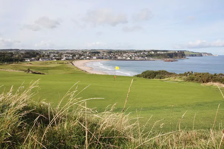
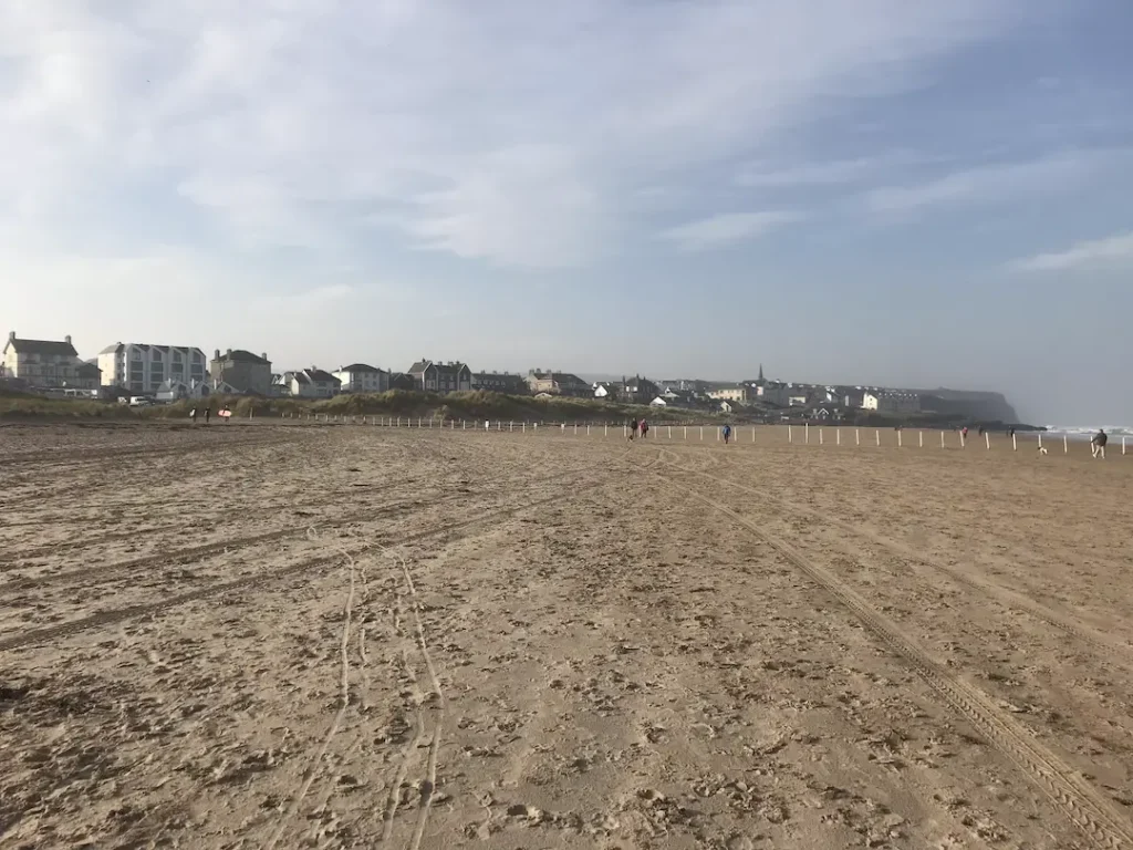
Bushmills lies just 6 miles (9 km) east along the Causeway Coastal Route, past Royal Portrush Golf Course and Dunluce Castle.
From Belfast is around 60 miles (97 km), 11 miles (18 km) from Ballycastle and 9 miles (14 km) from Coleraine.
By Car
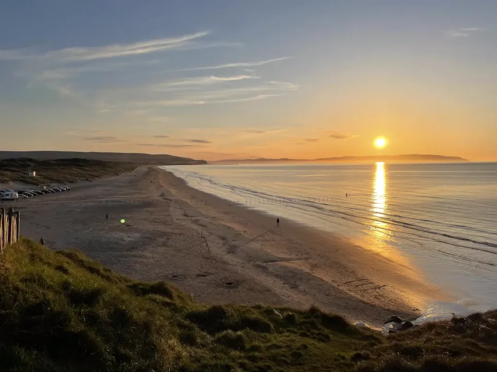
The easiest way to get there is via car, which will take around 15 minutes; however, there are several viewpoints such as White Rocks Beach, Magheracross and Dunluce Castle that we recommend you stop and take in the fantastic scenery.
From Belfast and Dublin, the best way is to follow the A2 Causeway Coastal Route, which snakes its way along the coast through some of the most spectacular scenery in Ireland. This route as you can see on the Map Below takes around 2 hours direct…. but its worth taking longer to stop along the way

However, you can drive straight from Belfast up to the M2 then A26 north towards Ballymoney, turning off at the Portrush Road Roundabout taking the third exit onto the B62 (Ballybogey Rd). Once on the Ballybogey road follow it for 6.7 miles and take a right onto the Priestland Road. Follow this until you get to Bushmills.
Public Transport
From Portrush, you can take the Translink 172 or 402 (Ballycastle) bus from Dunluce Avenue. It takes around 20 minutes and drives along the coast. You can find the timetable here.
If you are coming up from Belfast or Dublin, then one of the simplest ways to get to the castle is by taking a train. You can take a train from Dublin Connolly Station (The Enterprise) Changing at Belfast Lanyon Place LINK TO TIMETABLE. The train from Dublin to Belfast is around 2 hours and from Belfast to Portrush is approximately 1.5 hours.
You will then have to either get the bus from Dunluce Avenue or take one of the plenty of Taxis just outside the station.
Walk
 You can, of course, walk the Causeway Coastal Way from Portrush to Bushmills along the coastal path through Whiterocks Beach, Past Royal Portrush Golf Club, Dunluce Castle and through Portballintrae.
It’s around 7 miles and takes approximately 2.5 hours depending on how many stops you make along the way to take in the scenery.
You can find out more about this walk on the Walk NI Website
History

Bushmills village, was initially known as Portcaman, can trace its heritage back to Norman times (1150-1520). The Normans of Bushmills divided the lands into structured deaneries and parishes, each with its church.
The River Bush runs through Bushmills acted as a natural boundary between the parish of Portcaman on the western bank of the river, and the parish of Billy on the Eastern bank. In the mid-1600s, owing to the abandonment of Dunluce Castle and its neighbouring village, Portcaman and Dunluce Parishes merged.
With the development of more advanced use of water-powered industry from the 1600s, the village expanded and developed and the village gained its new name reflecting this. From historical documents, Bushmills was said to have at least seven working mills on the river Bush – corn mills, flax mills, paper, timber and a spade mill – and at least five distilleries.
In the 1690s, with the “Discovery” of the Giants Causeway by Frederick Hervey, Bishop of Derry, owner of Mussenden Temple and Downhill House, and later by Sir Richard Buckley who presented to the Royal Academy, Bushmills became a gateway and stopping point for eager visitors on their way to see the magnificent grandeur of the Causeway.
With the increase in visitors came a rise in stature of the village. Bushmills by the mid-1800s had at least three hotels, busy livestock and produce market and a thriving distillery. The Macnaghten family built much of the village including the Clock Tower and Market Square, Kane’s Commercial & Family Hotel, The Court House and the new bridge.
 The world’s first hydro-electric railway came to Bushmills, in 1883, link Portrush, by now a fashionable seaside resort with its railway line to Belfast, and the village.
Ironically, due to the railway line from Portrush extending to the Giants Causeway, Bushmills was now bypassed, and the hotels and local trade went into rapid decline.
With the increased prominence of steam, gas and electricity power, enabling the industry to have their factories closer to the suppliers, the use of water power started to wain, meaning the village was left to rely on the success of the ‘Old Bushmills’ Distillery.
It wasn’t until recent times that tourism began to re-emerge as a significant benefit to the town.
Fortunately for Bushmills, the village suffered very little from unsympathetic property developments of the late 20th century, primarily due to Bushmills being officially designated as a Conservation Village with nearly 90 listed buildings.
Places of Interest
Shell Row
This quaint row of seven cottages on the way out of Bushmills towards the Giants Causeway was built by the Macnaghten family, in 1820, specifically for the families of the workers on the Dundarave Estate.
 If you look closely at the windows, you may notice that uniquely, under each window the lintel is made of a hexagonal column of Causeway Stone, thought to be from the Giants Causeway. A couple of the cottages also have stones outside the front door.
Over the years the Shell Row Cottages have been home to many workers and former worker for the Mcnaghten family and their nearby estates, including nail makers, farm hands and mill workers, today they are all privately owned.
In April 1928, the cottages hit the headlines when a curious incident occurred.
Mrs Eliza Joab, a laundress for Miss Macnaughten of Runkerry House and Lady Macnaghten of Dundarave House, was ironing clothes using a new petrol iron when it suddenly went on fire.
She threw a piece of heavy cloth on the iron which also ignited. In a bit of a panic she ran out into the yard to get a wet sack, the moment she left the kitchen, there was a tremendous explosion sending the iron through the roof damaging the ceiling and roof slates as well as blowing out the window of the back bedroom — fortunately Miss. Joab who was severely shaken by the experience was unharmed but refused to use a petrol iron for a while.
The Bushmills Railway

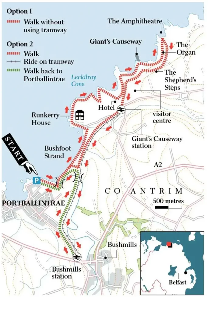
The Bushmills Terminus is on Ballaghmore Road, opposite Bushmills Primary School. William Traill of Ballylough pioneered the Tramway and engineered by the Siemens Company; this was the worlds first public hydro-electric Tramway.
Powered by the River Bush, the line opened in 1883 between Portrush and Bushmills with a later extension to the Giants Causeway.
The Tram operated on its original route until 1949, when it closed. It reopened in 2002, however, now only runs between Bushmills and the Giants Causeway.
You can find out more about the Bushmills Railway Here
Alphabet Angel

The Bronze sculpture, behind the visitor information centre, was created in 2004 by the artist Ross Wilson working with members of the local community. It represents the currency of language and the unique local tongue (dialect) of Ulster-Scots. It was the first public bronze sculpture created to celebrate the Ulster-Scots dialect anywhere in the world.
The Sculpture has a plaque at its base to describe the meaning of the various parts of the Sculpture.

The paving stones leading up to the Sculpture also have an Ulster-Scots poem inscribed in them.
The Poem reads
Here A stan Lukkin tae this
waitin Ian Whar yince a hirdin weetchil stud
Loast a wee atween dreams an sa
Or dreamin sa Streetchin braid afore him anither ree
Anither flock braid-gethered thranger far
This Ian that cried the dreamer bak for This is hame
James Fenton
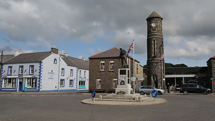
The Market Square

As part of efforts to improve the villages staus, a market was established in 1827. The square itself was built around 1840 by William Henry Macnaghten and was designed to be the focal point of the new town.
The Market Square, considered to be substantial at the time, had two gates facing towards the street along with covered areas in behind to protect goods like grain during wet market days. Grain, linen yarn, pork, poultry, eggs, milk, vegetables, butter and livestock, were all available at the markets.
Two markets took place each week during the 19th century, a primary market every Tuesday and a smaller market on a Friday. In 1833 a linen market opened but was not successful and subsequently closed.
The town also held four annual fairs March 28th, June 28th, October 22nd and December 12th. These were held out on the street in front of the square. A Hiring Fair also took place twice a year. Men, women and children would come to the twice-yearly Hiring Fairs. Here they line up and offer their services as labourers and domestic servants; many would find employment on local estates, farms and farm homes.
When the Tram opened in 1883, the line ran down to the market square and facilitated the carriage of goods to the harbour at Portrush. Grain, butter and other products would be shipped weekly to England and Scotland.
The Clock Tower

In order, perhaps, to give the town a bit of gravitas Francis Macnaghten erected the Clock Tower in 1874 on the edge of the Market Square.
It is modelled on classic Irish round towers which were common at monastic sites such as those on Devenish island and Glendalough. John Hall built the tower and today is one of the iconic Bushmills landmarks. An alcove which exists on the front of the tower once contained a water trough for horses. Before the early 20th century the elegant conical roof of the original tower was replaced with a plainer tapered.
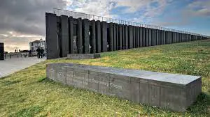
The War Memorial

The Bushmills War Memorial entitled, Situated in the centre of Market Square designed and created by well known Victorian sculptor Charles Leonard Hartwell RA, FRBS, RBC (1873-1951).
The Petty Session District Court of Bushmills raised over £3000 to fund this memorial to the men of the town and surrounding district, who lost their lives in the Great War (1914 – 1918). Before its unveiling in Bushmills, the Sculpture had been on exhibition at the Royal Academy in London. Lady Macnaghten unveiled the statue on November 5th 1921.
 A plaque at the base was later added to the foot of the memorial in honour of Robert Quigg (1885-1955) who was a recipient of the Victoria Cross for at the Battle of the Somme on July 1st 1916.
Today a sculpture of Robert Quigg stands opposite the Bushmills Inn that was unveiled in 2016 by the Queen. You can find out more about Robert Here.
The Courthouse

The Old Court House stands on Main Street with its distinctive columnar portico and dominant presence. The Macnaghten family of Dundarave Estate built the Courthouse in 1834, to serve as the Petty Session Court for the district and a symbol of authority in the area.
The building contained a courtroom, cells and police apartments above. The Courthouse served for over 100 years as a Petty Session Court until it became a private residence in the middle of the 20th century.
The old doorway has seen the passage of endless people, answering summonses, seeking justice or merely to witness the court goings on. Most cases heard here were local misdemeanour’s. More severe or ambiguous cases would have a preliminary hearing here and then be passed on to the Crown Courts.
The range of crimes dealt with in the 1800s echoed the poverty of the rural areas. Through the Petty Session reports of Bushmills, we can take a look into the past, beyond the individual cases and into the places, characters and colour that made up everyday life in the village.
From these records, we can see that living conditions then were barely sufficient with homelessness dispossession commonplace. Crimes like poaching, begging, lifting fallen timber, or stealing bread or a free-range chicken were usual.
The last person to live in the Courthouse lived on the ground floor in the early 1960s. A resident fondly remembers her image thus: ‘I remember her standing at the front door in the gathering dusk, her slight figure silhouetted against the oil lamp in the hall behind. No doubt she often wondered what would become of the old place.
Klondyke Terrace

This quaint row of terraced houses was built at the beginning of the 1900s and named after the Klondyke region of the Yukon in North-Western Canada where Gold was discovered in 1896. Funding for the construction of the Terrace came from gold found in the Klondyke, reflecting the widespread emigration and settlement of local people in that area.
The Mills
Currys Mill

Formerly and locally known as Curry’s Mill, the Mill was named after a former owner James Curry. The Mill is believed to date from circa 1816 and consists of two buildings, a three storey random rubble Mill building and a two storey double Kiln Building with a red brick lean-to at the northern end.
The Corn Mill remained in operation until the early 1950s and in the 1990s was converted to a private residence. In 2012, with assistance from the Bushmills Townscape Heritage Initiative, the Kiln was also converted to residential use, and the Mill Wheel rebuilt.
An Ordnance Survey map of 1832 shows two buildings, one being the existing Kiln building and the other being a building on the site of the primary Mill itself. As the Ordnance Survey map of 1857 has a different configuration the original Mill, which was running parallel to the Kiln and not at 90 degrees as it is now, it must have been replaced before 1857.
Though the Kiln appears to be the same on both the 1832 and 1857 Ordinance Survey maps the stonework variation between both ends would suggest that both parts were built at different times.
The kilns were located on the ground floor with red brick furnaces. There was a very steep single open staircase to the first floor where there was an external door to take the grain. The grain would have been spread out on perforated iron square plates, the perforated holes allowing the heat from the furnaces in the two kiln rooms below to permeate through. When dry, the grain was shovelled into rectangular wooden shutes for collection in sacks below.
The red brick lean-to was a later addition and did not appear on the 1902 Ordnance Survey map. It was used as the Mill Office and had its fire and chimney stack in the corner. Behind the Kiln, the building is the Salmon Fishery which was the site of a Scutching Mill (Flax) that was operating at the same time, part of this old Mill now forms the main central block of the fishery building.
Palmers Mill

Palmer’s Mill, sitting on the eastern bank of the River Bush, is also named after a former owner, acquiring its current name in the 1920s. Palmers Mill is thought to have built between 1825 and 1850. The Mill continued to operate as a corn mill and Kiln for over 100 years until the 1960s when it fell into disuse.
It is believed that an older water powered buildings stood on the site of the current Mill beside a ford that would have been the main crossing point into the village until the construction of the bridge over the River Bush.
The present owners Sam and Jan Huey took on the massive task of completely restoring the old Mill to the condition you see today complete with a fully working water wheel and associated interior mechanisms.
The Mills in Bushmills have always played a significant part in the history of the village. At one time there were at least seven in operation along the river Bush, between the Walkmill Falls and St Colums Rill at the bottom of the town. Directly behind Palmer’s Mill, was another water wheel which powered a Saw Mill run by James Dean.
The Smiling Cow

The Smiling Cow was created through community and relationship building workshops with young Catalonian students from Spain, who were staying in Bushmills to better their English, and the Bushmills youth club.
Both groups shared each other’s national identity and culture through a cross-community project. The smiling cow idea won in a competition decided by the young people.
The cow contains symbols which are connected to the heritage, history and culture of Bushmills. You can see all the elements that have made Bushmills what it is today including the Distillery, Dunluce Castle, the Giant’s Causeway, the Salmon, Market Square, War Memorial and the Corn Mills which gave the village its name. The smiling cow is a welcoming symbol, welcoming visitors from all over the world to this Conservation Village.
Bushmills Distillery

Well, we couldn’t write about Bushmills without mentioning the wee distillery at the top of the hill.
Bushmills and the surrounding area has had a long history of distillation. It is said that, as far back as 1276, A Sir Robert Savage, possibly the one of the Knights Templar and Archbishop of York, before leading his troops into Battle, fortified them with “a mighty drop of acqua vitae”.
Although stories and records are dating back further, it wasn’t until 1608, that Sir Thomas Phillips (An Irish adventurer) was granted a licence by King James I (James VI of Scotland) to distil whiskey in Bushmills.
“for the next seven years, within the countie of Colrane, otherwise called O Cahanes countrey, or within the territorie called Rowte, in Co. Antrim, by himselfe or his servauntes, to make, drawe, and distil such and soe great quantities of aquavite, usquabagh and aqua composita, as he or his assignes shall thinke fitt; and the same to sell, vent, and dispose of to any persons, yeeldinge yerelie the somme 13s 4d”
Hill 1887
The company that we know today as Hugh Anderson only established the Bushmills Old Distillery Company in 1784. Bushmills was not always as popular as today, suffering many lean years with several periods of closure, there is no record of the distillery being in operation in the official village records both in 1802 and in 1822.
In the late 1850s, the distillery was bought by Jame McColgan and Patrick Corrigan two spirit merchants from Belfast; forming a limited company 1880. In 1885, a fire destroyed much of the original Bushmills buildings, but the distillery was swiftly rebuilt.

In 1890, the SS Bushmills, steamship owned by Bushmills Distillery, sailed across the Atlantic on its maiden voyage to deliver Bushmills whiskey to the Americas. It called twice on the eastern seaboard at Philadelphia and New York City, before heading on to Singapore, Hong Kong, China and Japan. Sadly she ran aground and was wrecked on Nimrod Rock, Penrhos Bay, Anglesey on the 11th January 1911 when on passage from Liverpool for Cardiff in ballast. She was refloated on the 26th August 1911 and broken up Llanerchymor. Read more at HERE
The golden years between 1880 and 1920, Old Bushmills’ ‘celebrated malt whisky’ wins numerous prizes in international spirits competitions, including the ‘only gold medal for whiskey’ at the Paris 1889 Expo. North America was a massive market for Bushmills and most other Irish Whisky producers and this time. Prohibition in 1920s America came as a massive blow to the Irish Whiskey industry; however, Bushmills managed to survive. This was primarily due to Bushmills’ owner at the time, Samuel Wilson, who predicted the end of prohibition and had taken a gamble on buying the distillery at the start of the ban to store large quantities of whiskey ready to export to the United States.
World War II halted production as Allied troops were billeted at the distillery. Meanwhile, in Belfast, a bomb hit the head office destroying all the archives. After the Second World War, Isaac Wolfson bought the distillery, who then in 1972, sold it to Irish Distillers, who at the time controlled the production of all Irish whiskey.
Since then the distillery has passed through ownership by Pernod Ricard in 1988 and then Diageo in 2005.
In 2015 Jose Cuervo got a fantastic deal by swapping some a half share in some tequila brand for control of one of the finest producers of whisky in the world, we don’t know who it was, but you can be sure they are toasting that deal with a Wee Toddy of Bushmills finest.
In May 2008, the Bank of Ireland issued a new series of sterling banknotes in Northern Ireland which all feature an illustration of the Old Bushmills Distillery on the obverse side, replacing the previous notes series which depicted Queen’s University of Belfast.


PS There is £50 note….but we couldn’t get hold of/afford one of those. lol.
Best Places To Eat in Bushmills
Bushmills is often overlooked by those travelling along the Causeway Coastal Route, to the likes of the Giant’s Causeway, Carrick-a-Rede and Portrush without stopping, and we feel this is a mistake, as there are some fantastic places to eat in the village.
We’ve compiled a list of the Best places to eat.
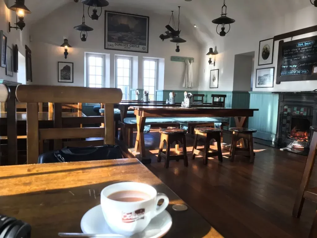
The Bushmills Inn

If there is one place that is going to persuade you to stop overnight in Bushmills, it’s the Bushmills Inn.
This multi-award winning former Coaching Inn, dating back to the 1600s, is a 4-star boutique Hotel and Restaurant is steeped in history. The 4 star Bushmills Inn blends unique rooms, beautiful grounds, stunning architecture and lovingly restored modern facilities that pay homage to its rich Irish history.
From inglenook turf fires to hayloft snugs, there’s something to find behind every door.
It’s has a cosy bar with the real fire (lovely after a windswept trip to The nearby attractions) that regularly hosts traditional music sessions… the inn even has its secret library and fantastic outdoor area…..apparently they have amazing Espresso Martini.
As an extra treat, they even host their cinema on special occasions.
Address: 9 Dunluce Rd, Bushmills BT57 8QG
Mick’s Coffee Shop

Mick’s is one of the best places on the Causeway Coastal Route for a fry up, however, as one of the surprising and delicious secrets is that one of the owners is originally from Thailand, therefore does some of the best Thai meals around; always check out the daily Thai special.
Address: 65 Main Street, Bushmills BT57 8QB, Northern Ireland
The Copper Kettle

If you are looking for a real Ulster Fry ( pancake ..yes pancake, soda bread, bacon, egg, sausage, potato bread (known as fadge locally) and either tomato or beans, then this is one to stop at.
In our short experience, if your not in by 10 on a Saturday morning, then you may struggle to get a seat as its very popular with cyclists and locals, who seem to have the serving times down to a tea before there’s a mass exodus along the coast road and the scrumptious lunchtime food served up by Carol and her staff.
This is a friendly, comfortable café situated on the corner of the market square on the road from Dunluce Castle to the Giant’s Causeway. Stop off and fill up ahead of your next activity.
Address: 57a Main St, Bushmills BT57 8QA
The French Rooms

On the Mains Street of the village, opposite the Visitor information centre and handy for the park and ride to the Giants Causeway, a recently opened and refurbished guest house, the French Rooms, is a pleasantly relaxed, informal and friendly licensed café/restaurant offering simple French-inspired and elegantly presented dishes priced for regular visits and not just for special occasions. You have to try Stella’s sourdough French toast and homemade scones with local jam… Amazing!
Or you can enjoy a cup of the best-pressed coffee (approved by the inlaws!) tasted in a long time; this will pick you up and give you a kick start for a wander around the local art galleries.
Address: 45 Main St, Bushmills BT57 8QA
Tartine at the Distillers’ Arms

Gary (the owner/head chef), Stephen (his main sidekick in the kitchen) and Paul (the restaurant manager) have created a physically beautiful space, glamorous yet welcoming, stylish yet comfortable.
The food exceeds all expectation that even the high standards that we roll out. , Gary and his team produce some of the best food along the Causeway Coastal Route, using the local, award-winning produce in ways that induce a Pavlovian Response upon hearing the name.
Gary Stewart, Tartine, has won many awards including Restaurateur of the Year, Northern Irish Tourism Award for Best Food Tourism Experience, is listed in the Georgina Campbell Ireland Guide and is current all-Ireland Chowder champion….so may be worth a try of the chowder.
Address: 140 Main St, Bushmills BT57 8QE
Mini Maegden

It’s not often anyone recommends visiting a converted campervan for quality food. However, this teeny, tiny little camper van is worth more than a mention. Parked up close to the village, across from the Giant’s Causeway it is a food lovers heaven.
Grilled cheese sandwiches with loads of local artisan fillings and homemade pickles make this for a delicious and filling choice, especially after the brisk walk down to the Giants Causeway and back.
The two girls who have set it up (the ‘maidens’ of the name; the ‘mini’ will become apparent when you see the van!) are ex-teachers who wanted to fill people’s stomachs instead of their heads. How glad are we that they did!
Sourdough bread, fantastic local cheeses such as Young Buck, Dart Mountain Cheeses, Cavanbert, etc. are paired with award-winning meats such as Corndale Farm charcuterie, Broughgammon Farm goat, etc.
Inventive, delicious veggie alternatives are generally served, too. The pickles range from sharp and sweet to seriously spicy – all of them a perfect match to the oozy delights of the grilled cheese.
Address: 29 Causeway Rd, Bushmills BT57 8SU
Coopers Deli

Coopers Deli is a takeaway Sandwich Bar, that takes its name from being run by the family that has produced four generations of Coopers to Bushmills Distillery. Run by Fiona, they offer a selection of freshly made sandwiches, Subs, Paninis and the foot long panini dog. We really recommend you try the Pulled Pork served on a Brioche Bun with lettuce, onion, peppers, bbq sauce, cheese & slaw… delicious! You can also replace the pork with pulled chicken, beef or even locally source Broughammon Goat. All our meat is from the local Butcher. Almost all of the Jams & Chutneys are homemade from fruit picked from Fiona’s own organic orchard. If you are passing in the evenings, then you really have to try the Pizzas, and pasta dishes all served from 5-9pm. It is made fresh to order.
We also stop in as she makes a fantastic cup of tea with a selection of scrumptious tray bakes.
Address – 57a Main St, Bushmills BT57 8QA
Ground Expresso

Adjacent to the Cenotaph, set behind the clock tower. It is often missed when driving through the village. However, Ground offers a brilliant local coffee experience, and they are excellent in their quality of service, coffee and food.
They have a great selection of coffees and teas to chose from and key for us, a space at the back filled with kids toys to keep allow us to have a hot cuppa for once.
The outside seating is lovely in the sunny weather, to enjoy a spot of people watching while enjoying a cup of tea and warmed cinnamon bake (highly recommended)
Address – 64 Main St, Bushmills BT57 8QD
Creative Gardens (one for parents)

Situated just outside the village, and easily missed, is Creative Gardens Centre. Aside from being a great place to pick up all things gardening. They have a great cafe attached to it. You have to walk through the centre to get to it, but it’s worth the walk, as they serve great food and drinks.
However, the best thing about Creative Gardens is their outdoor undercover kids eating and play area. A vast area with kids climbing frames, slides, play tractors and all within easy viewing of parents at their tables. No matter what time of year you visit Creative Gardens, its a pleasant experience thanks to the overhead heaters…also great to use to dry out.
Address – 88 Ballyclogh Rd, Bushmills BT57 8XA
Broughgammon Farm

Another recommendation that’s just outside the village on the way to Ballycastle is Broughgammon Farm. It’s only open at weekends and is run by the Cole family. They serve a great selection of Teas, coffees and tray bakes in a converted barn with roaring wood burner and rustic feel.
They are multi award winners for a number of things including
– Irish Food Writers Guild Awards 2019: Environmental Award
– Great Taste Awards 2016: 2-star award for Goat Bacon
– Best Snack (goat tacos) at The British Street Food Awards 2016
– Highly Recommended (2nd Place) at The British Street Food Awards 2016
However, the main reason to visit (aside from getting to visit the goats) is the well-stocked farm shop, full of Broughgammon fresh meat (Cabrito Goat), local produce, garden and foraged veg along with country crafts. Broughammon also hosts a number of Artisan masterclasses, butchery classes and seasonal courses throughout the year.
Takeaways
– a flash in the pan
– the hip chip
– China Garden
– the cods way
– Yi House
Bushmills Food Tours
If you love your food and want to fit as much into your trip as possible but don’t know where to start then, we would recommend a food tour.
Caroline at Irish Feast offers local, award-winning food & drink tours in the often overlooked Bushmills, Ballycastle and even on Rathlin Island.
Join this enthusiastic guide and stroll around Bushmills, visiting six unique eateries, while being introduced to the passionate people who grow, catch, make and bake this amazing local food.
Irish Feasts’ experience is set apart from your usual guided tour apart as she doesn’t just walk you around the village from stop to stop, but also points out little oddities you would probably miss otherwise.
On this tour, you’ll hear about locally sourced foods from the producers, chefs and shop owners themselves. They dive into the history and culture of the nearby coastline and countryside.
The one rule of Carolines is – come hungry!
FIND OUT MORE HERE.
Nearby
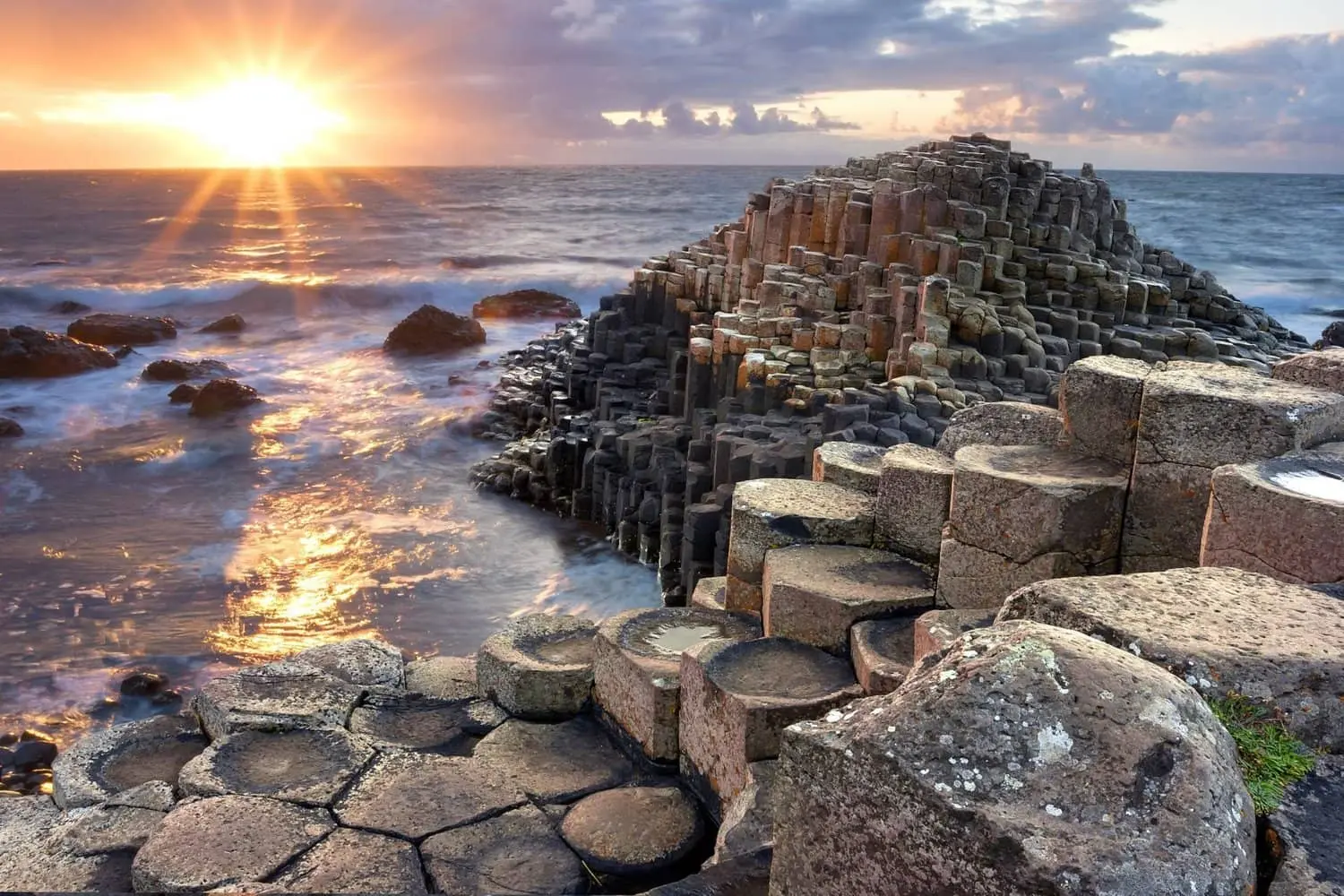
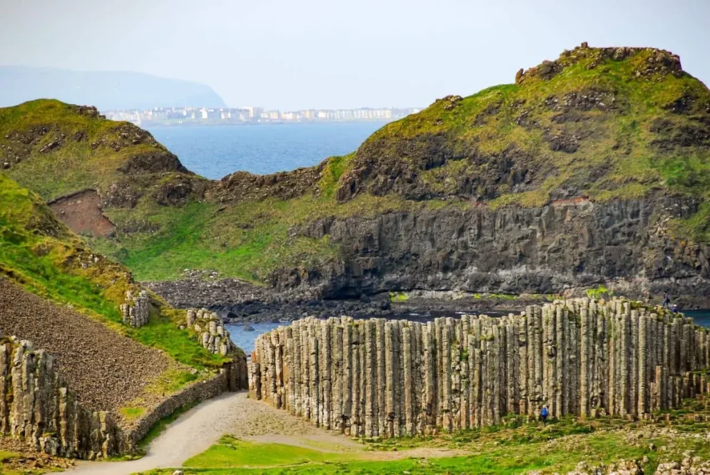
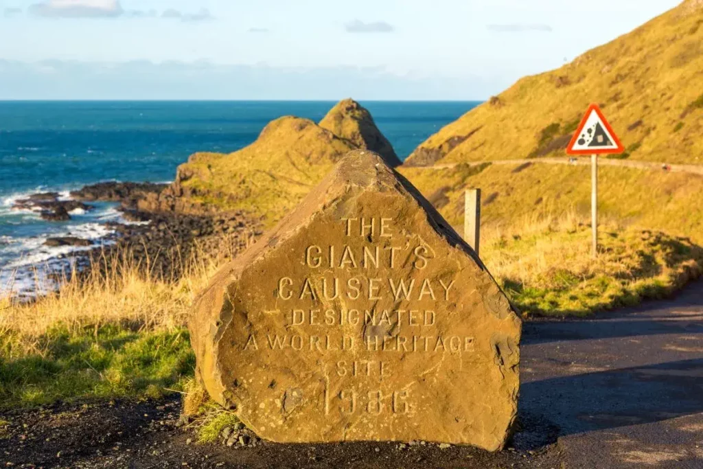
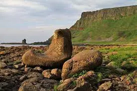
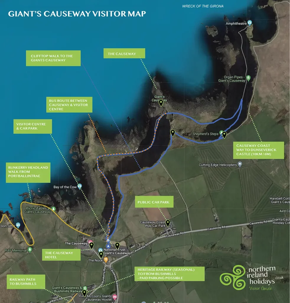
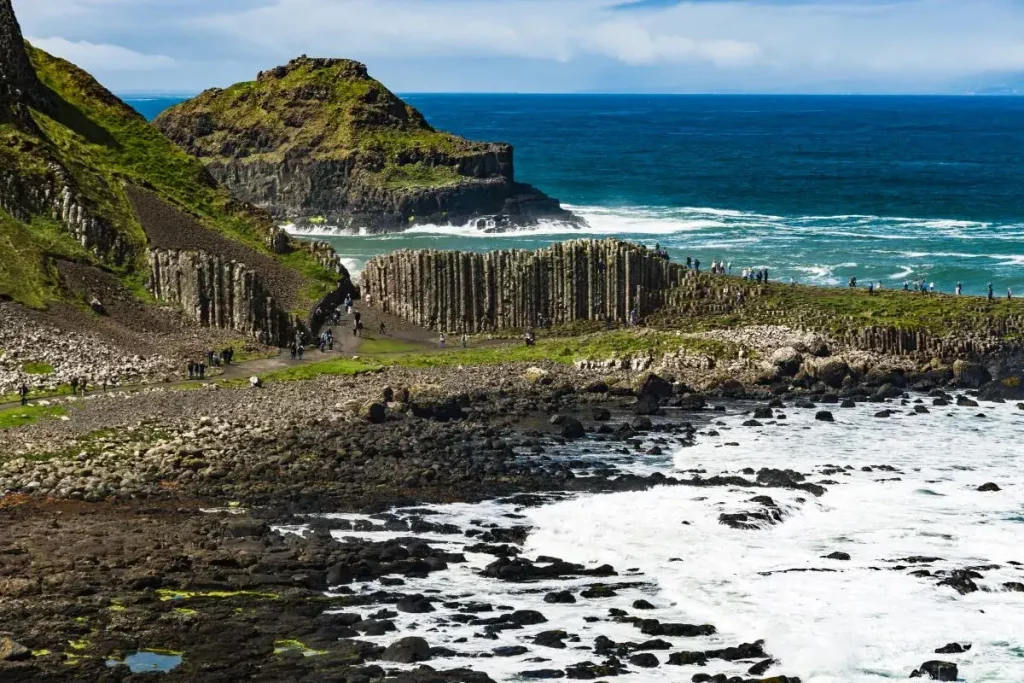
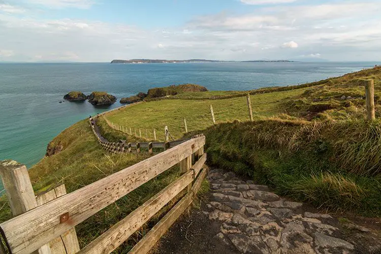
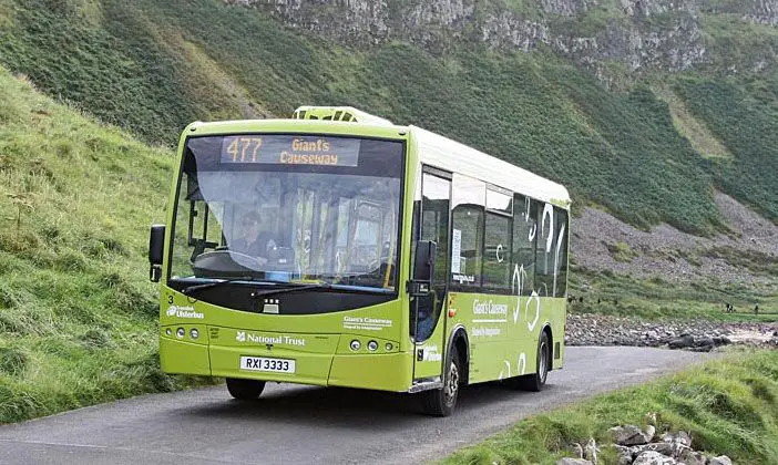
The Giants Causeway
The Giants Causeway is only 2 miles from the village.
Read our Guide here
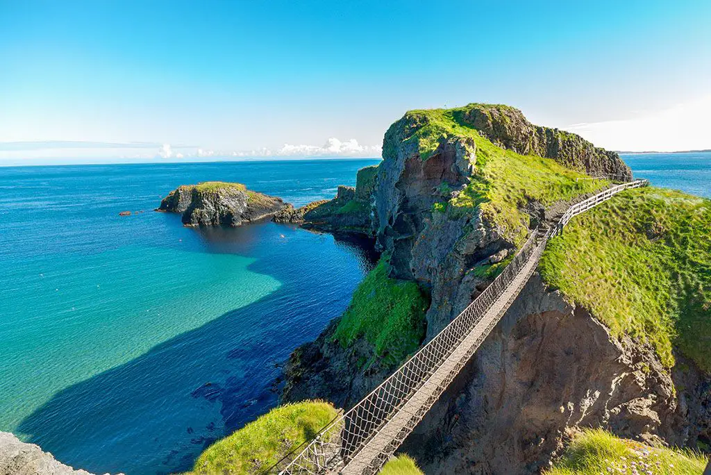
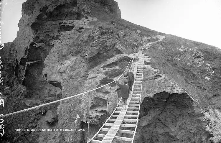
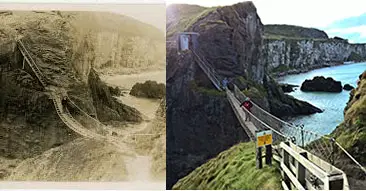
Carrick-a-Rede
Carrick-a-rede Ropebridge is 4 miles from the Village of Bushmills. Its owned by the national trust and takes a brave soul to cross it, 100ft above the crashing waves, and onto the island.
Read our Guide here
Ballintoy
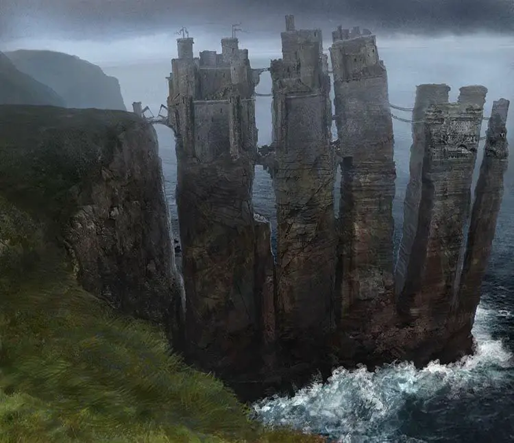
Ballintoy is situated in one of the most picturesque parts for the Causeway Coastal Route between the Giants Causeway and Carrick-a-Rede rope bridge. The area around Ballintoy has some exceptional walks, through amazing scenery that is steeped in local history. A short walk from the village is Whitepark Bay, one of the earliest settlements in Northern Ireland, with Portbradden on one side and Ballintoy Harbour (famous now for Theon Greyjoys Landing in Game of Thrones)
The Dark Hedges
The Dark Hedges are an avenue of ancient beach trees that over hang the old entrance road to Gracehill House. They have recently been made famous as The North Road in Game Of Thrones
Read our in depth guide
Portballintrae
Portballintrae is a quaint fishing village, set just outside of Bushmills and only minutes from the Giants Causeway and Dunluce Castle. This seaside destination is just like stepping back in time, with is an old coastguard station, Runkerry house and beach.
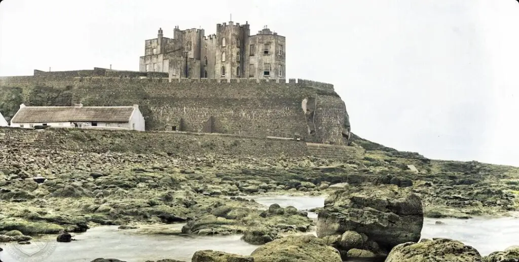
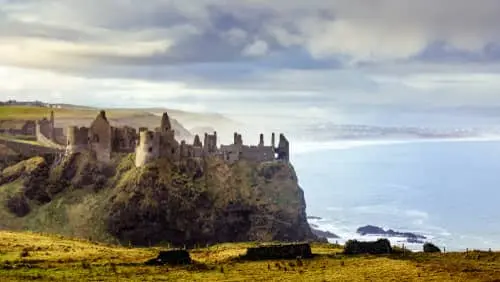
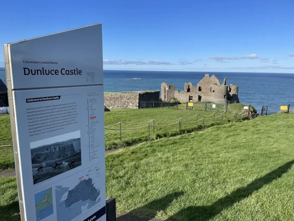
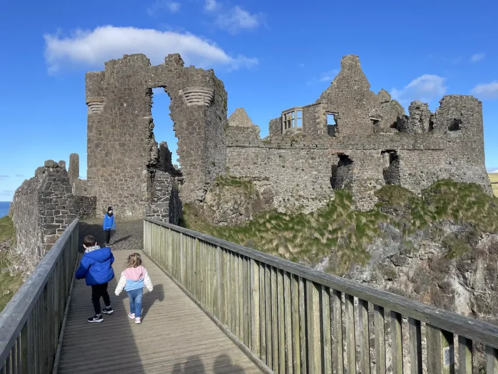
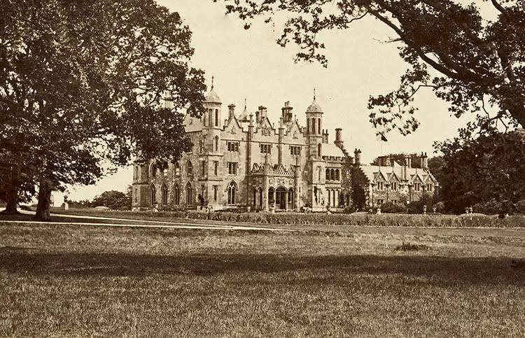
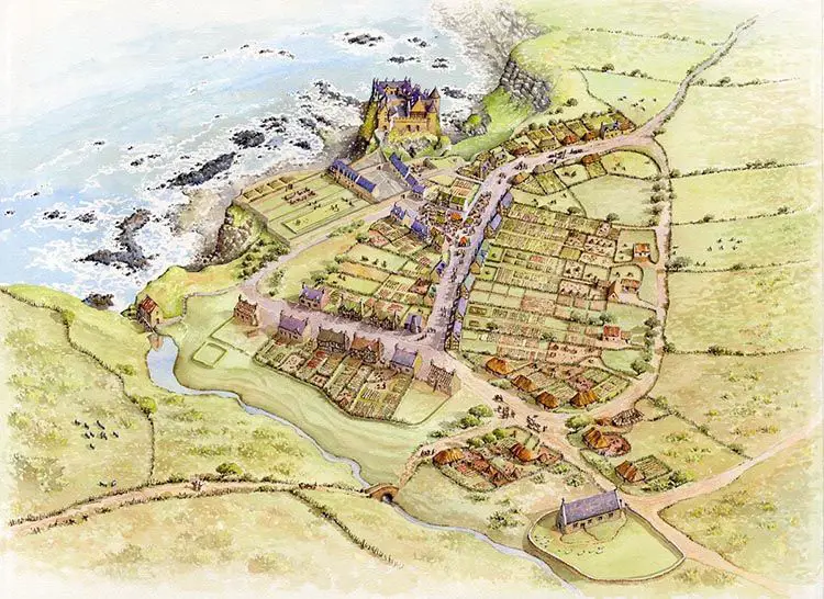
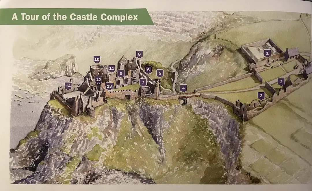
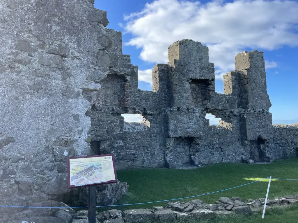
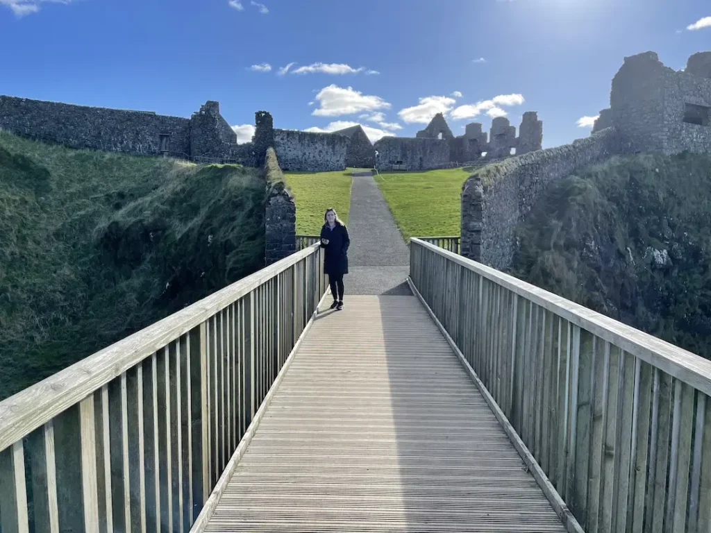
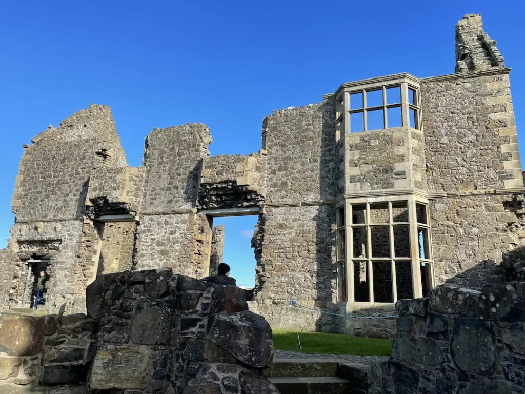
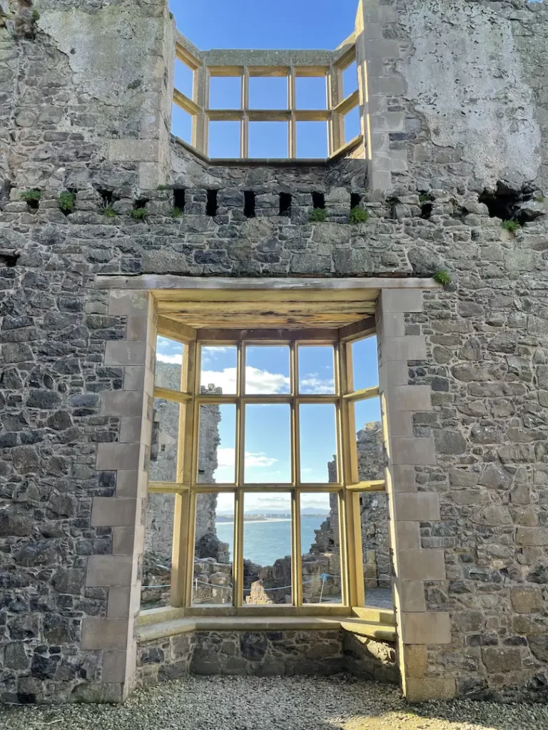
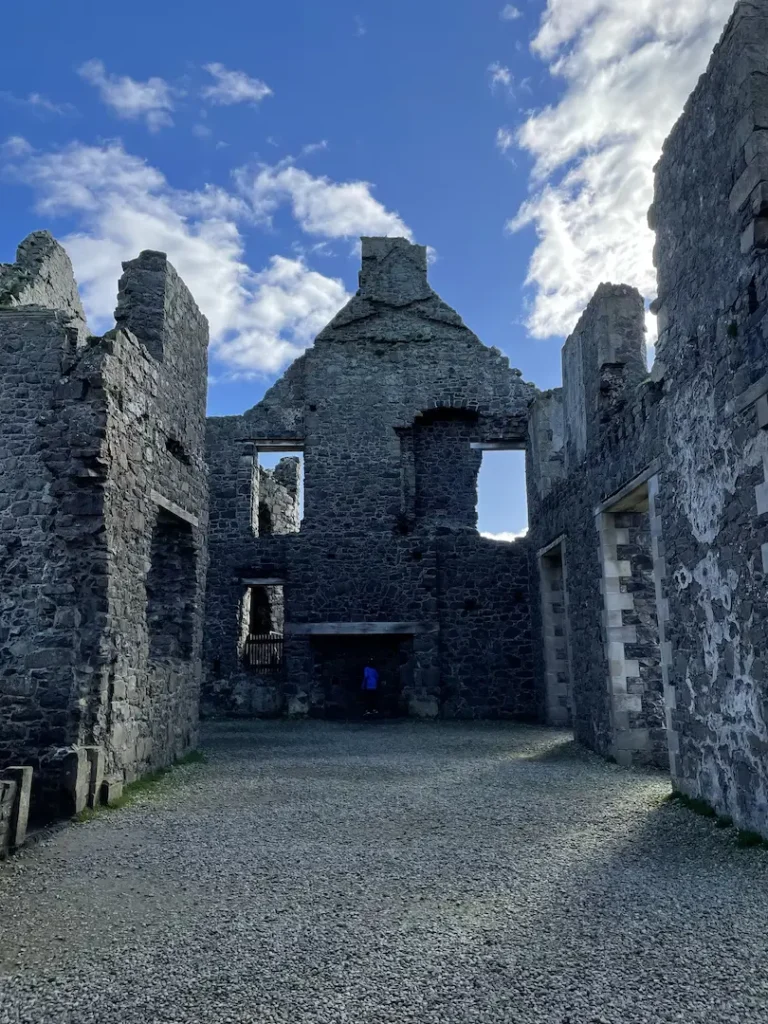
Dunluce Castle
Dunluce Castle is situated just a few miles along the coast towards Portrush. The Castle is perched on a craggy outcrop and has been made famous recently by the HBO TV Series Game Of Thrones.
We’ve compiled an awesome guide of Dunluce Castle for your here
So there you have it, we hoe that this has been useful for you in planning your trip. Wed love to hear about it, why not tag us on Twitter (@VisitPortrush) or Instagram (@VisitPortrush) when you are here